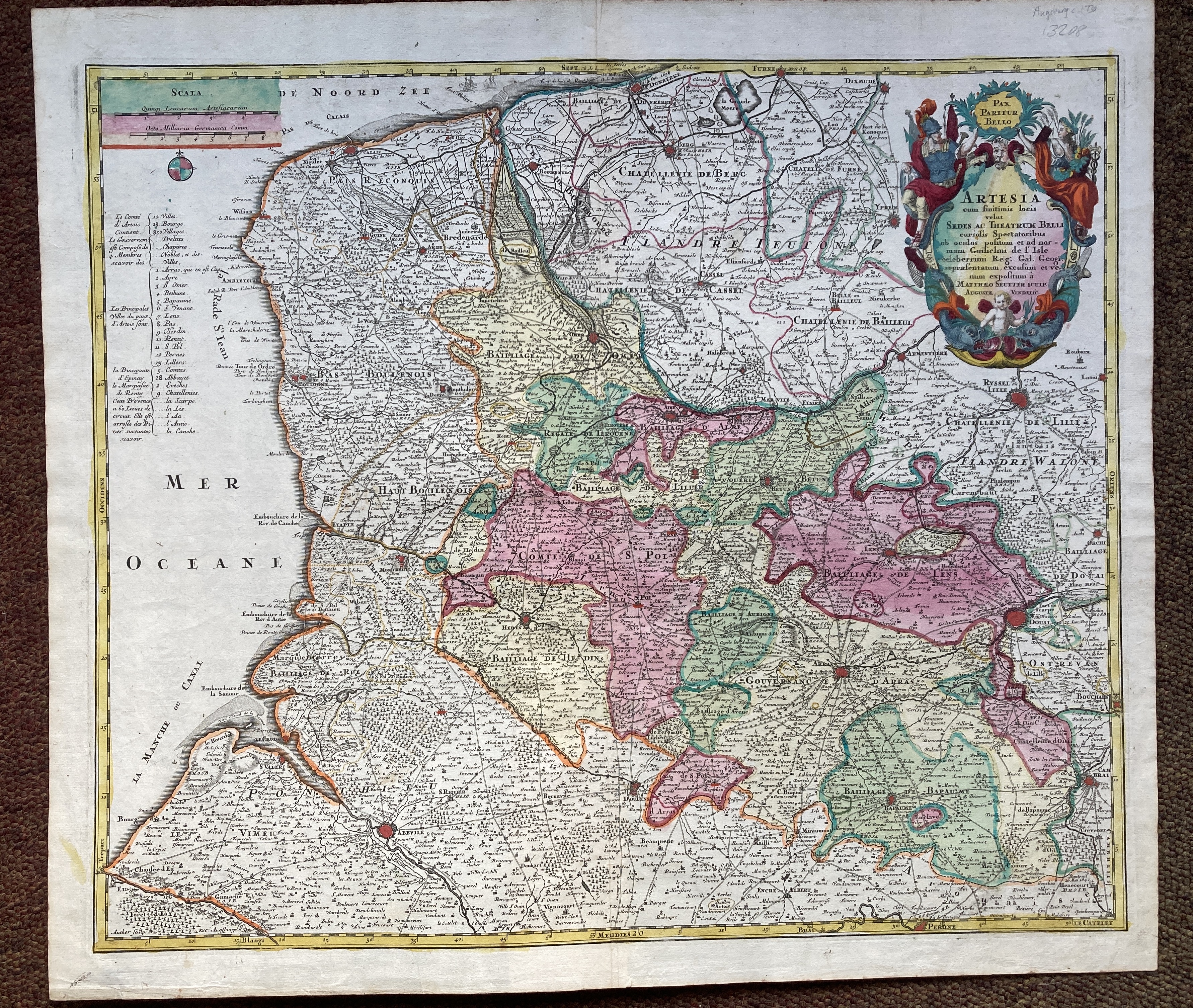
13208. Guilielmi de L'Isle and Matthaeo Seutter. ARTESIA. Circa 1730, Augsburg, hand coloured, overall size 605mm x 535mm, good margins, verso blank. Fine fresh copy. 200.00 pounds.
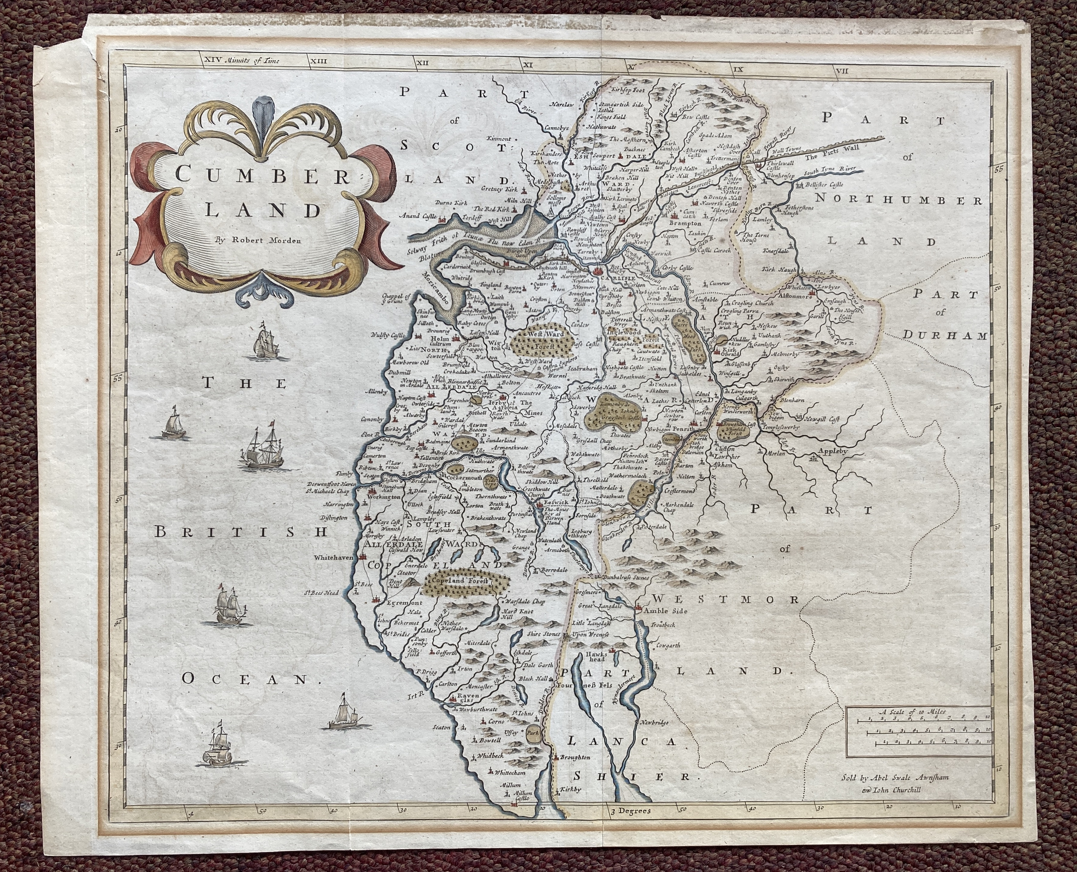
13212. Robert Morden. CUMBERLAND. Circa 1753, sold by Abel Swale Awnsham and John Churchill, 470mm x 390mm, hand coloured, with margins. Slight tear in top left hand corner, otherwise good.. 100.00 pounds.
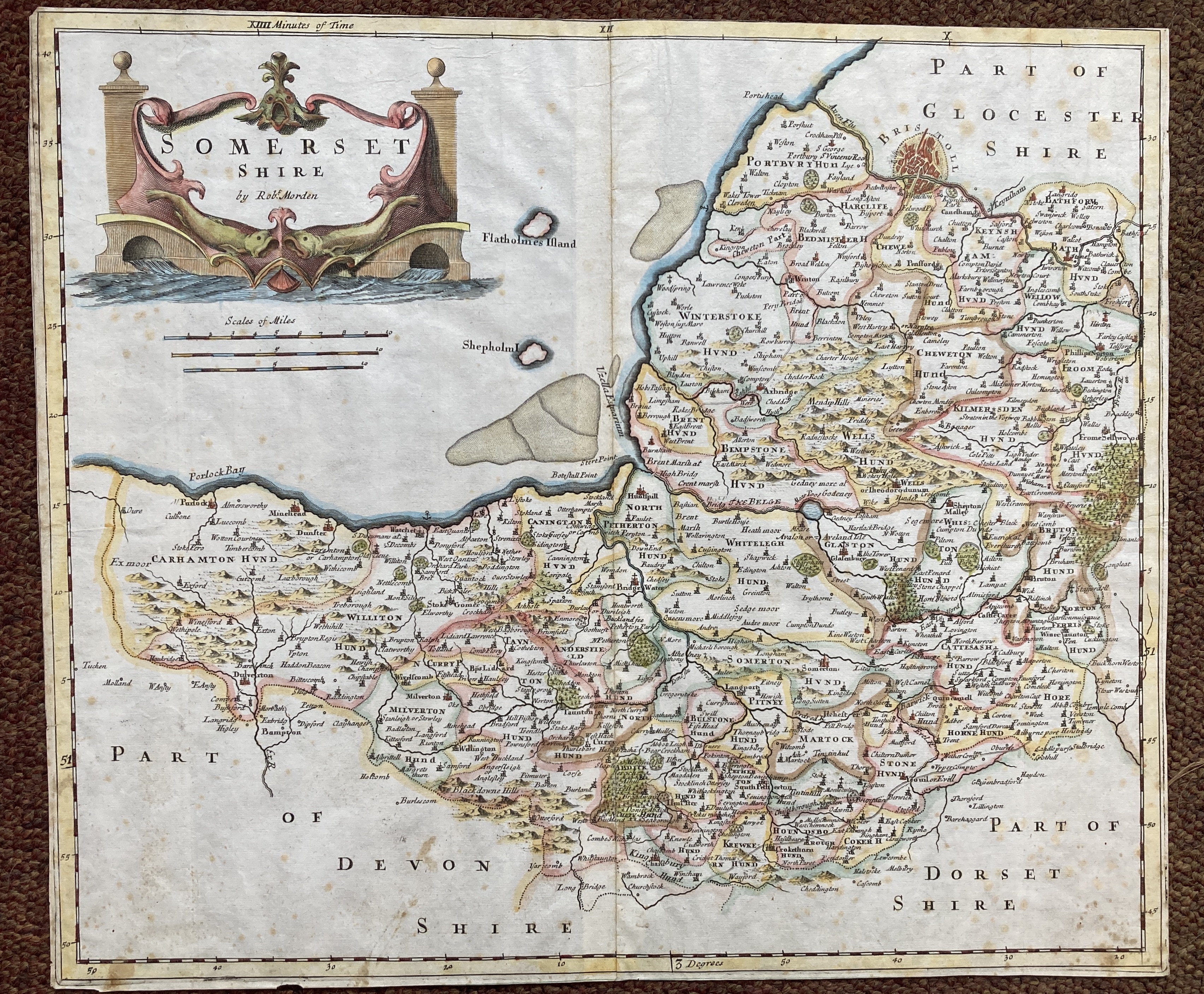
13214. Robert Morden. SOMERSETSHIRE. Circa 1695, no publishers details, 425mm x 365mm, trimmed to the edge of the plate, hand coloured. Good. 100.00 pounds.
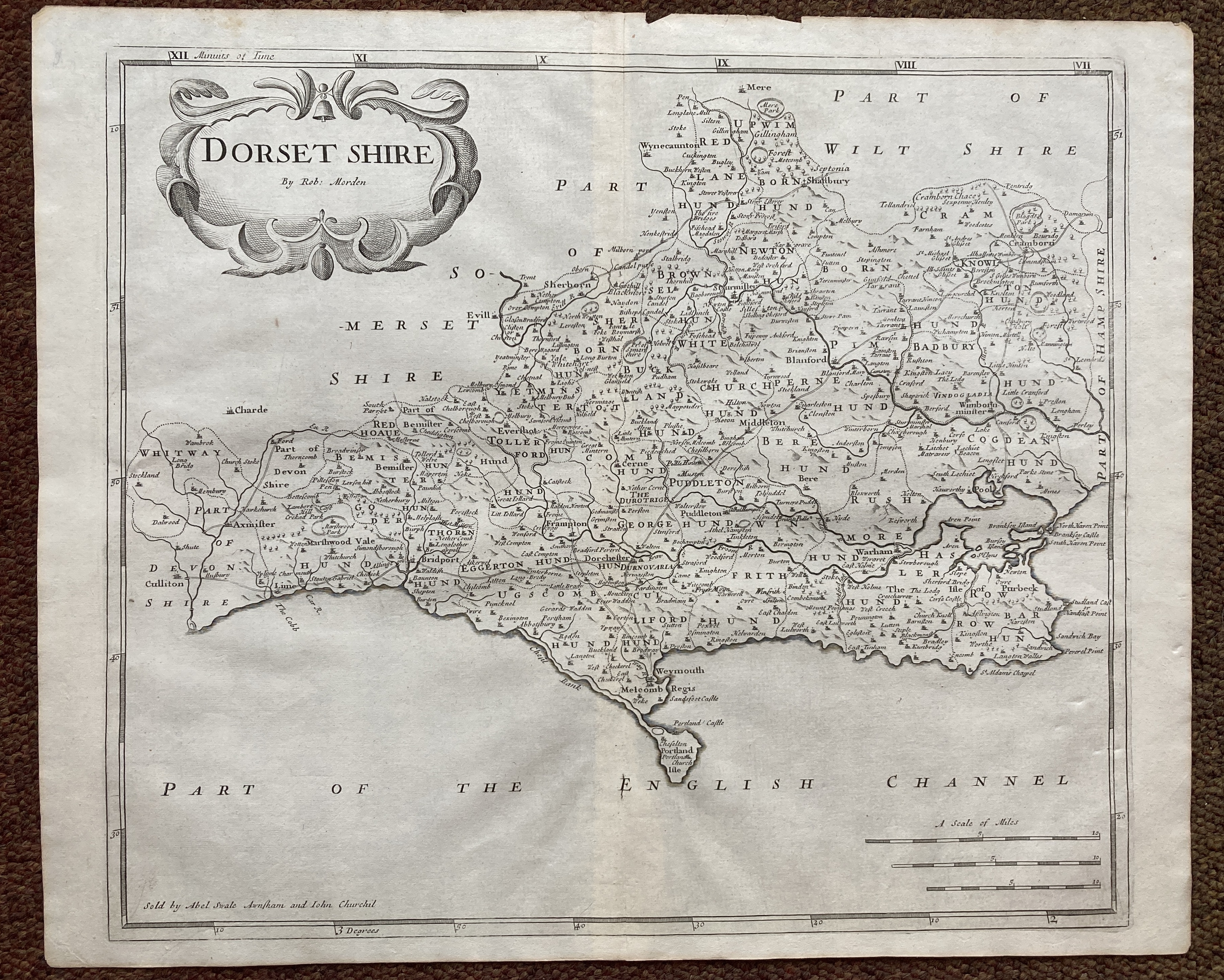
13215. Robert Morden. DORSETSHIRE. Circa 1720, sold by Abel Swale Awnsham and John Churchill, 470mm x 390mm, uncoloured, with margins. Good. 100.00 pounds.
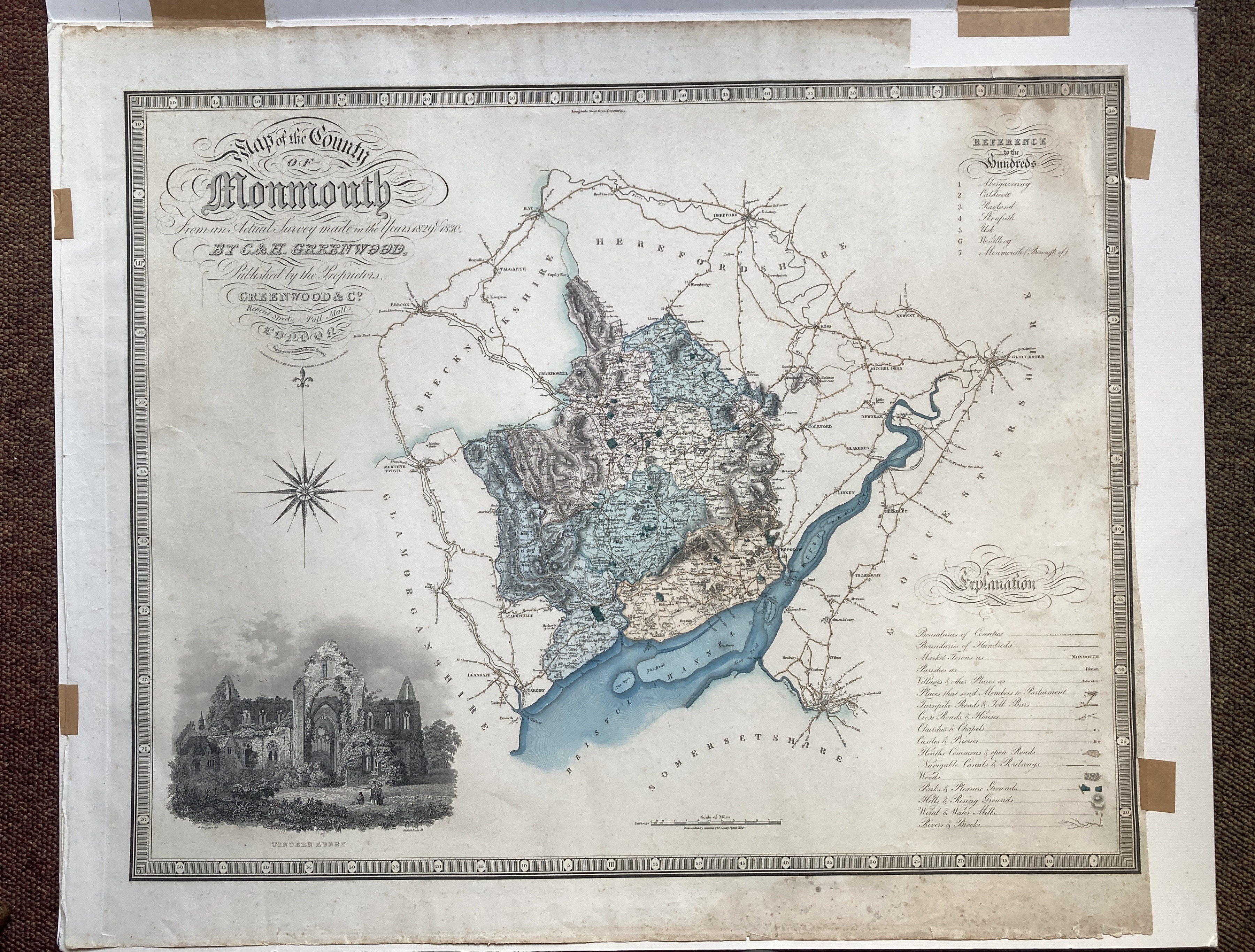
13216. C and H Greenwood. MAP OF THE COUNTY OF MONMOUTH FROM AN ACTUAL SURVEY MADE IN THE YEARS 1829 AND 1830. 1831, London, published by Greenwood and Co., engraved by Josiah Neele, hand coloured with an uncoloured vignette of Tintern Abbey, ornate title and rose, piano key margin, 760mm x 645mm, mounted. Slight crease, short tears in margin, otherwise good. 125.00 pounds.
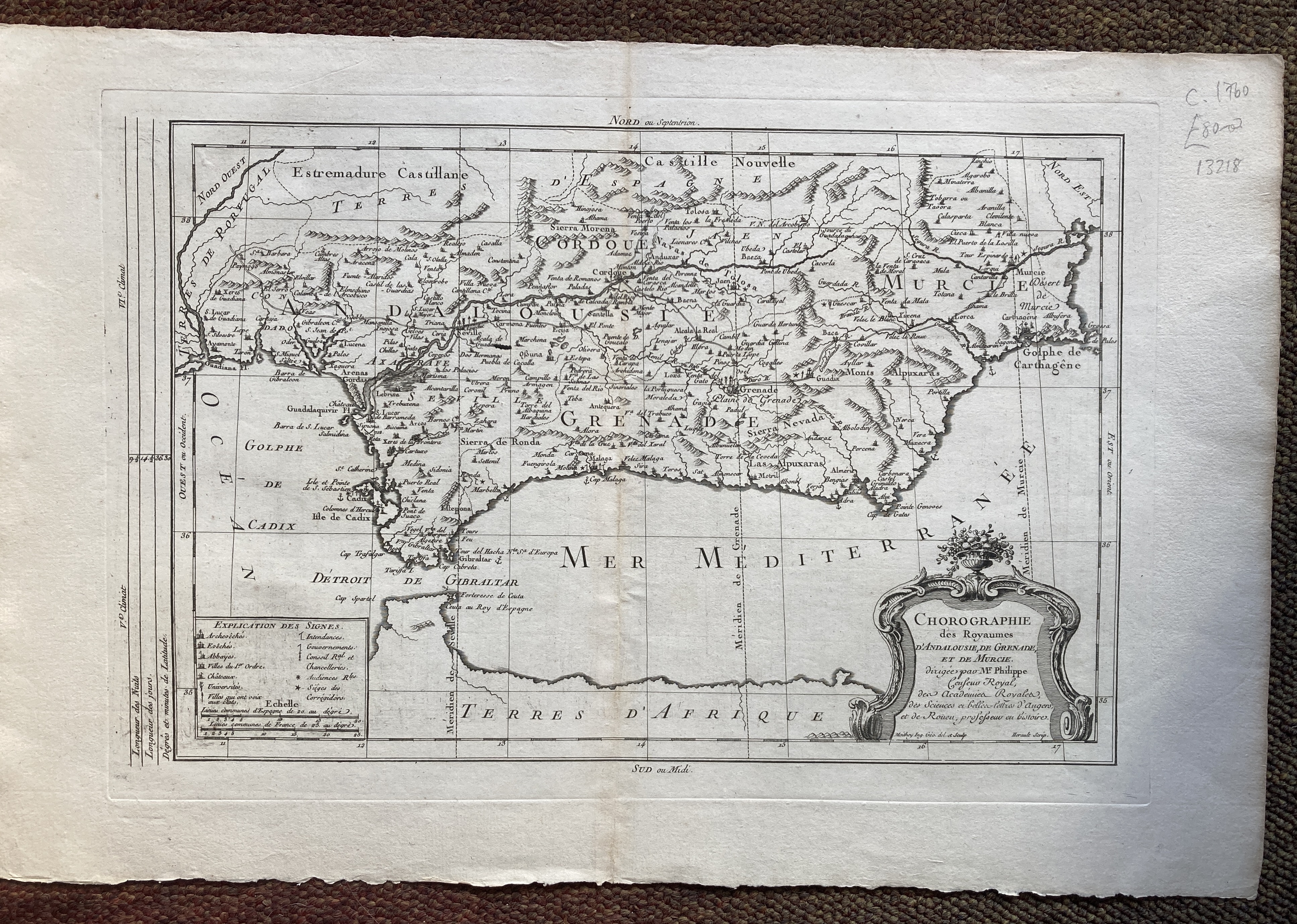
13218. [Mr. Philippe]. CHOROGRAPHIE DES ROYAUMES D'ANDALOUSIE, DE GRENADE ET DE MURCIE. Circa 1760, engraved by Moithey, text by Herault, uncoloured, 540mm x 350mm, with margins. Very good. 80.00 pounds.
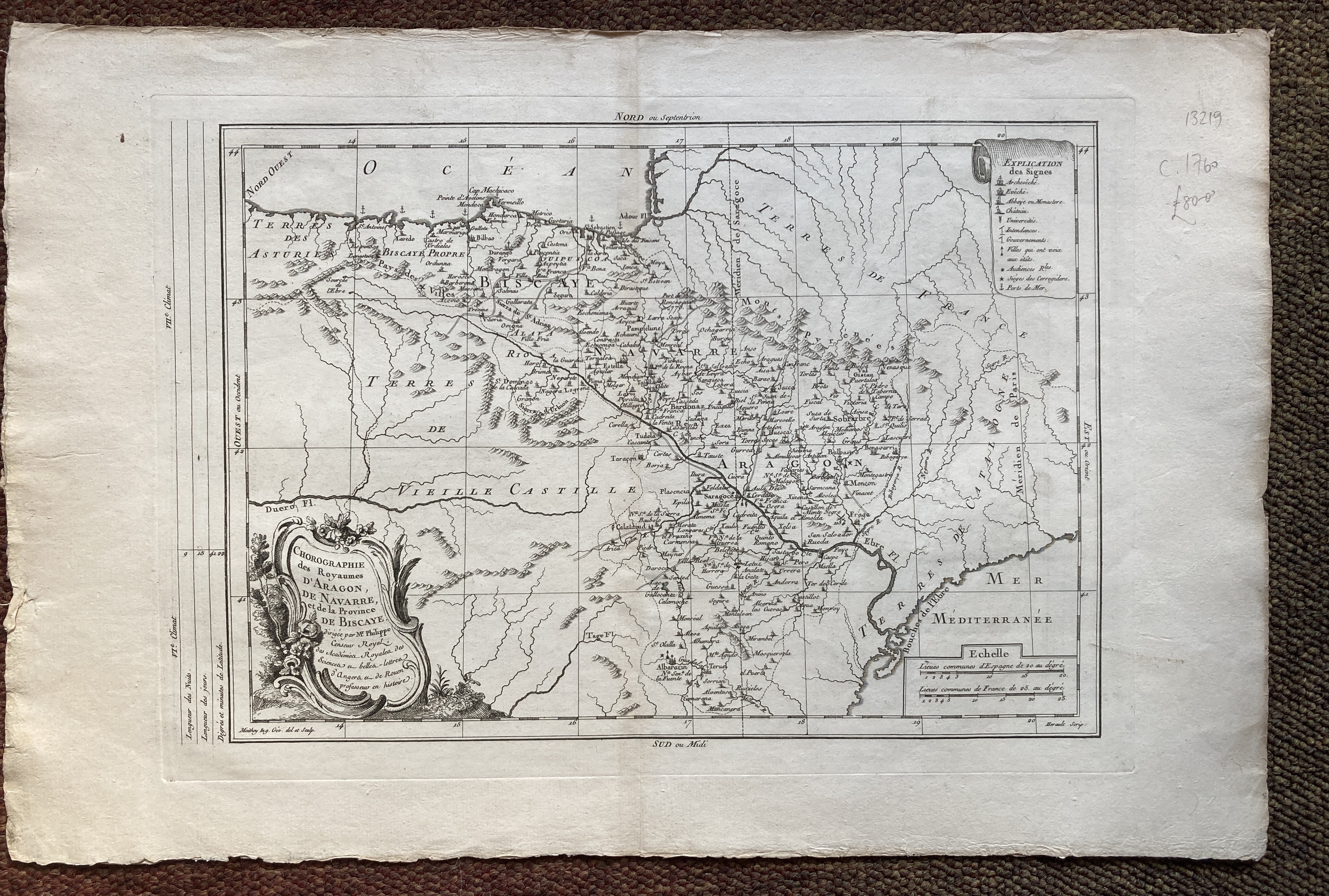
13219. [Mr. Philippe]. CHOROGRAPHIE DES ROYAUMES. D'ARAGON, DE NAVARRE ET DE LA PROVINCE DE BISCAYE. Circa 1760, engraved by Moithey, text by Herault, uncoloured, 540mm x 350mm, with margins.Very good. 80.00 pounds.
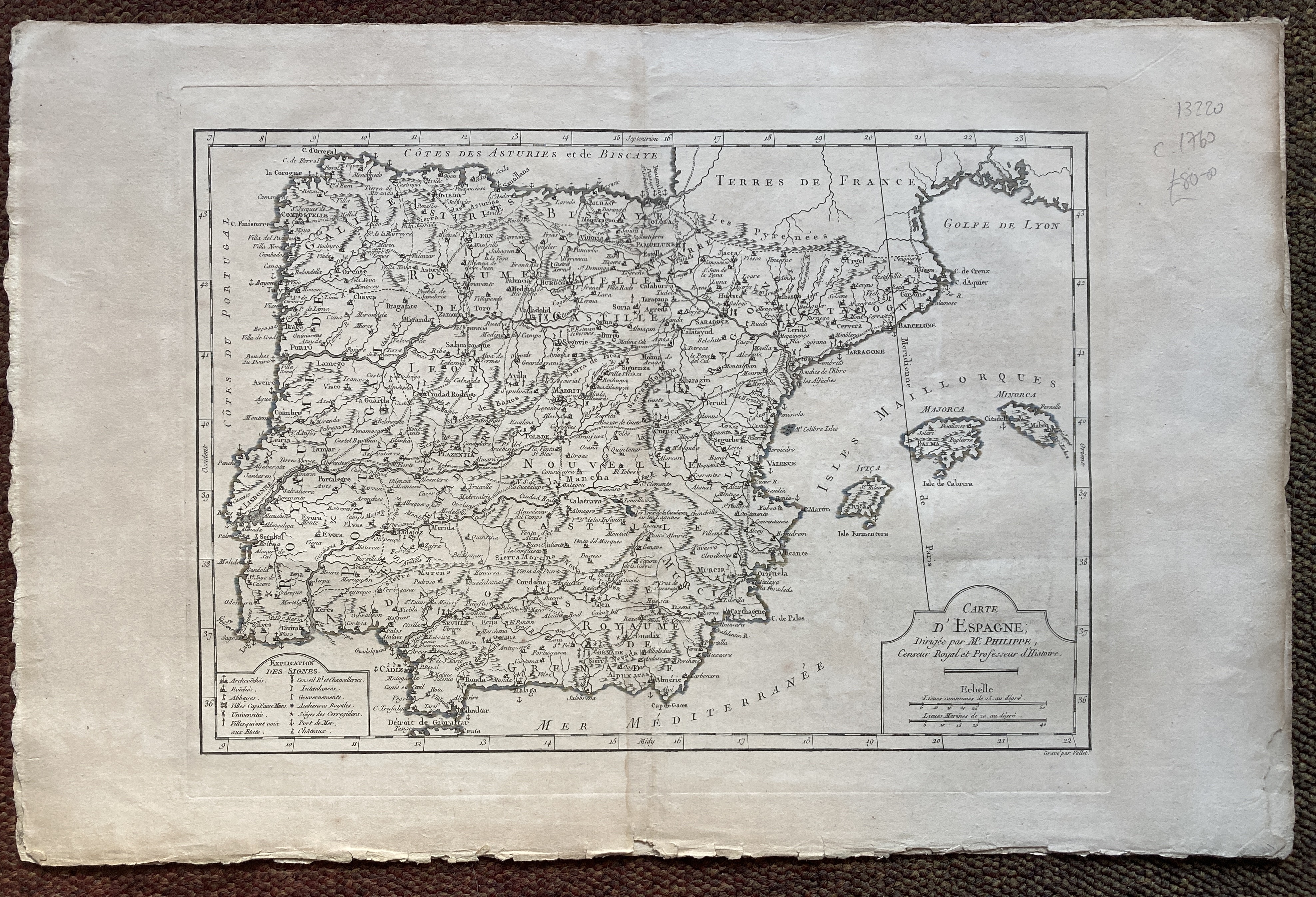
13220. [Mr. Philippe]. CARTE D'ESPAGNE. Circa 1760, engraved by Vallet, uncoloured, 540mm x 350mm, with margins. Very good. 80.00 pounds.
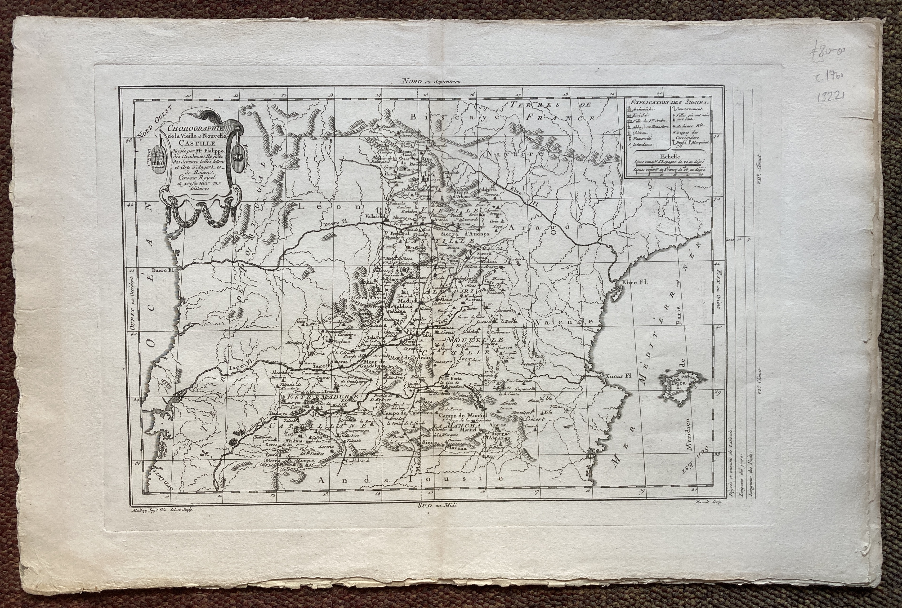
13221. [Mr. Philippe]. CHOROGRAPHIE DE LA VIEILLE ET NOUVELLE CASTILLE. Circa 1760, engraved by Moithey, text by Herault, uncoloured, 540mm x 350mm, with margins. Very good. 80.00 pounds.
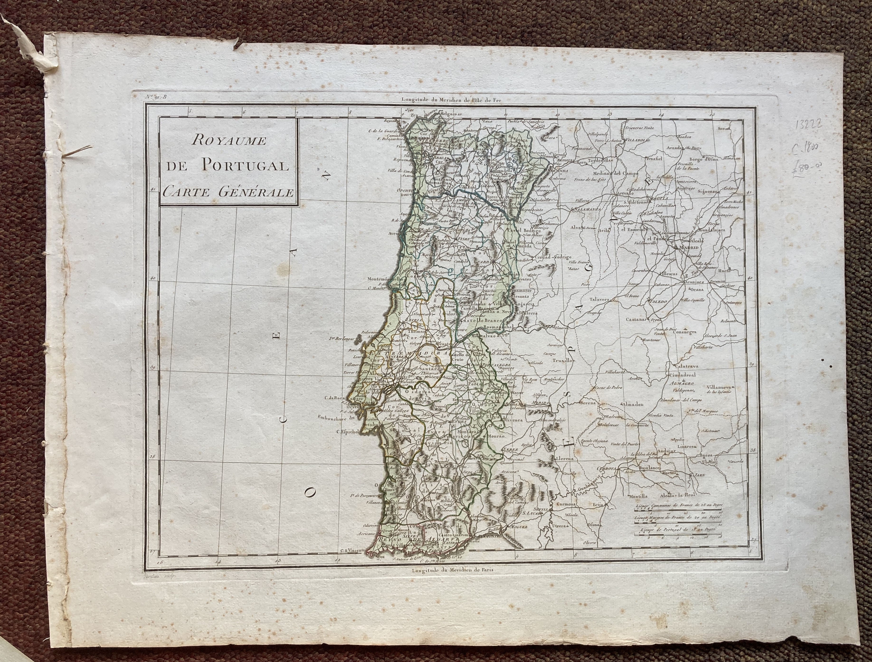
13222. [Tardieu]. ROYAUME DE PORTUGAL. CARTE GENERALE. Circa 1800, engraved by Tardieu, 560mm x 420mm, hand coloured in outline. Slightly spotted, worm holes in margin, otherwise good. 80.00 pounds.
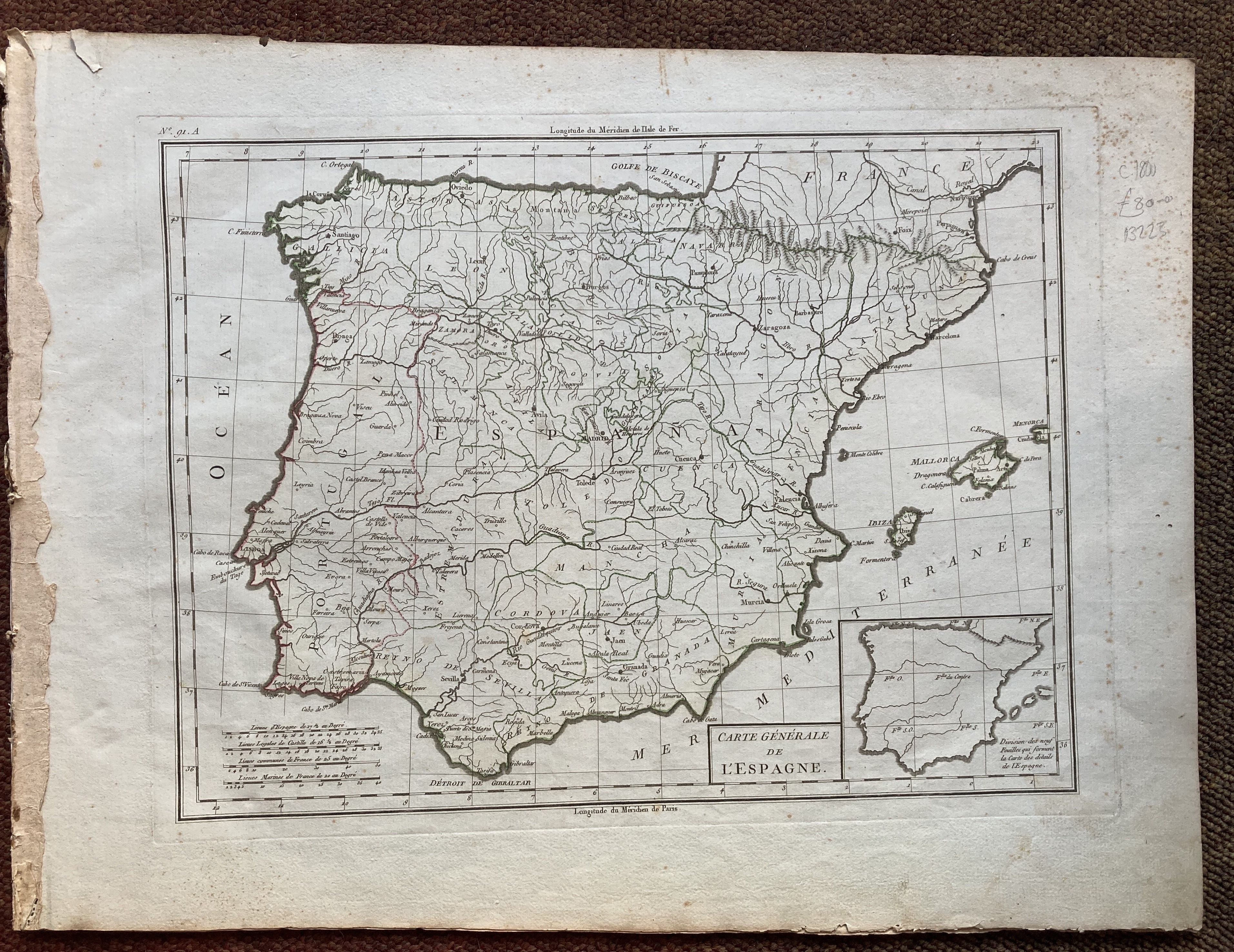
13223. [Tardieu]. CARTE GENERALE DE L'ESPAGNE. Circa 1800, engraved by Tardieu, 560mm x 420mm, hand coloured in outline. Slightly spotted, worm holes in margin, otherwise good. 80.00 pounds.
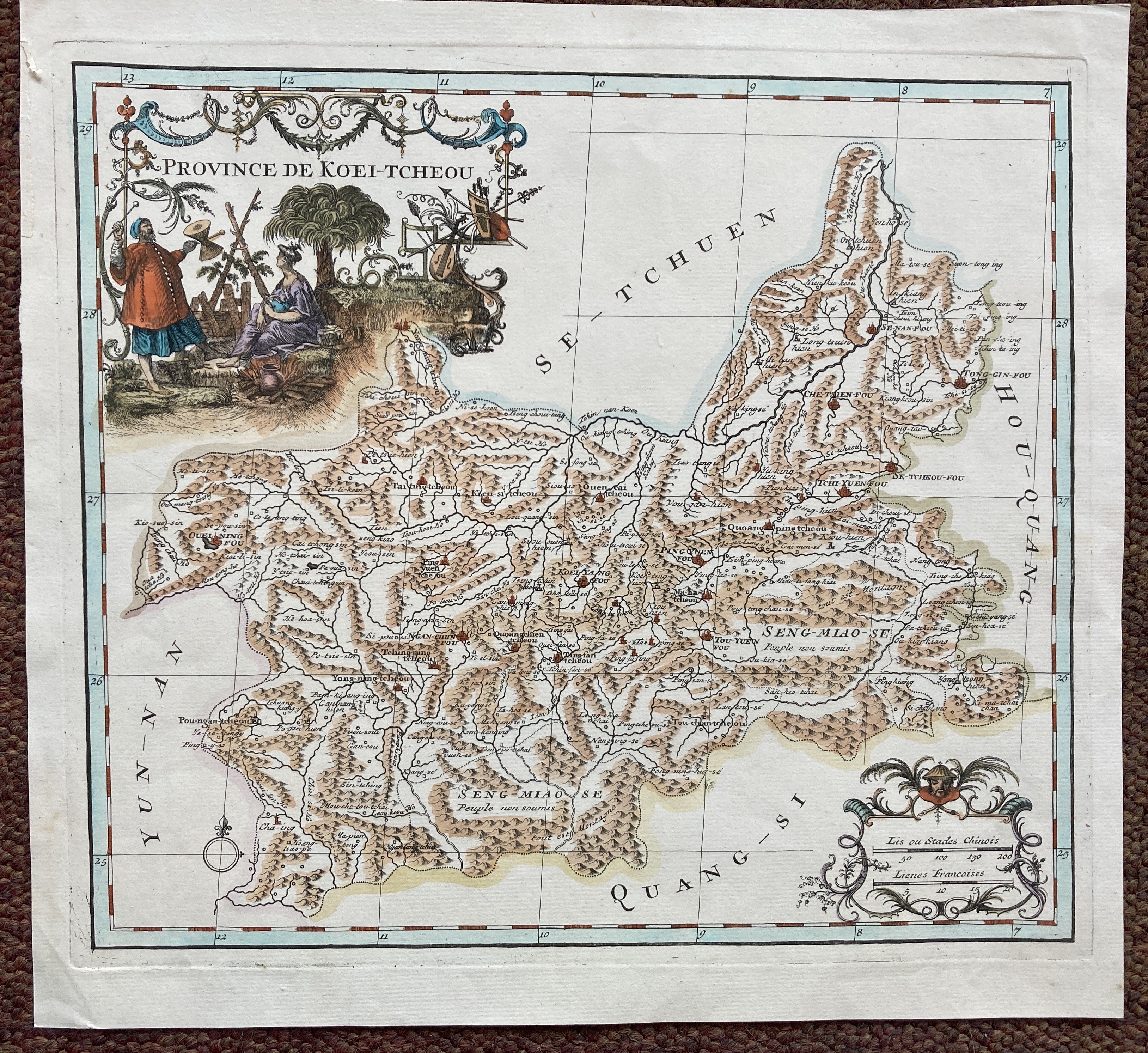
13224. Jean Baptiste Bourguignon D'Anville. PROVENCE DE KOEI-TCHEOU. 1737, engraved map, plate size 317mm x 280mm, ornamental cartouche, ornamental scale in Chinese and French lengths, hand-coloured, verso blank. Very good. 300.00 pounds.
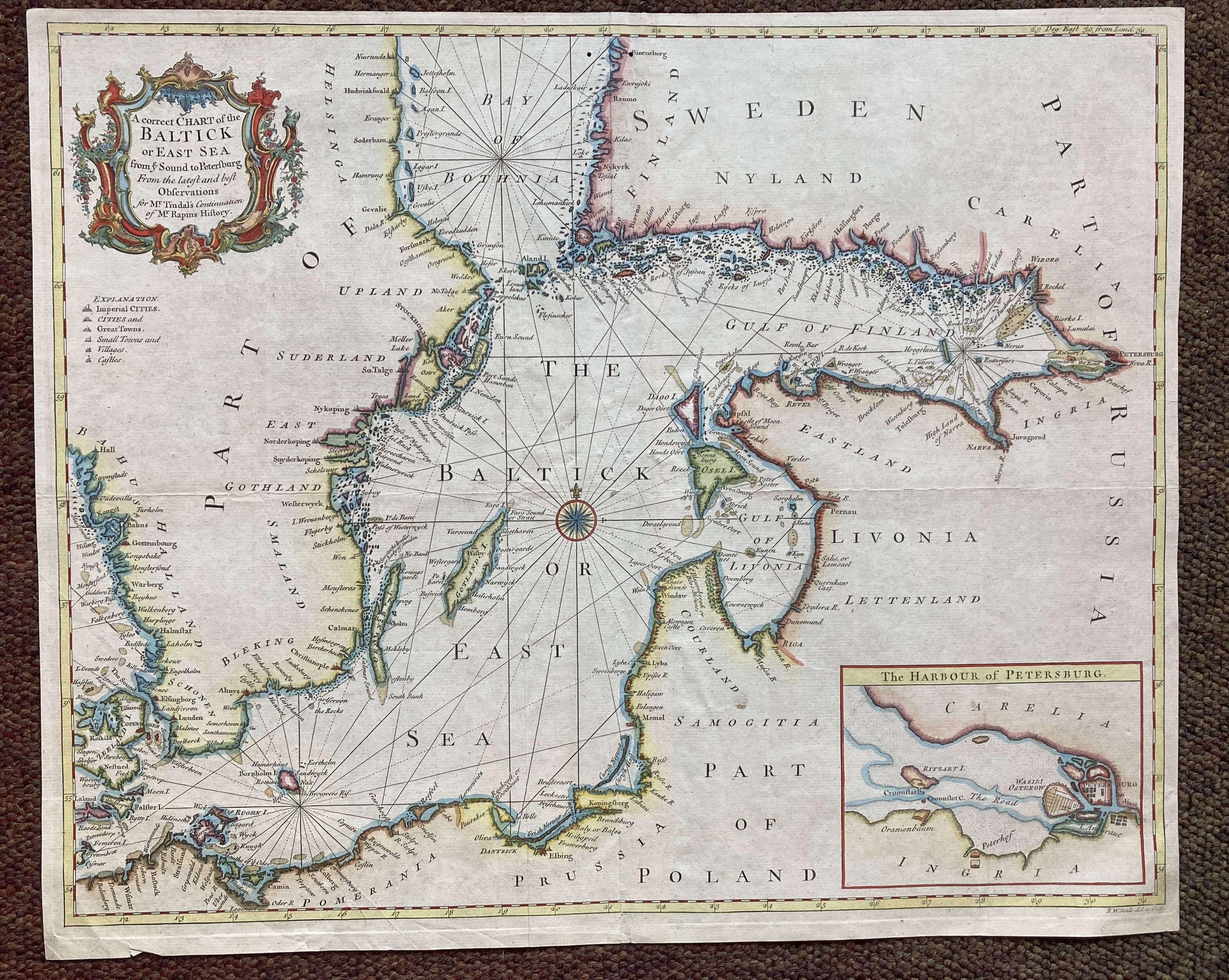
13228. R. W. Seale. A CORRECT CHART OF THE BALTICK OR EAST SEA FROM YE SOUND TO PETERSBURG. FROM THE LATEST AND BEST OBSERVATIONS FOR MR. TINDAL'S CONTINUATION OF MR RAPIN'S HISTORY. Circa 1744, engraved map, plate size 480mm x 390mm, ornamental cartouche, inset harbour of Petersburg, hand-coloured. One or two creases, slight tear on centre fold, worm hole near the top centre. 250.00 pounds.
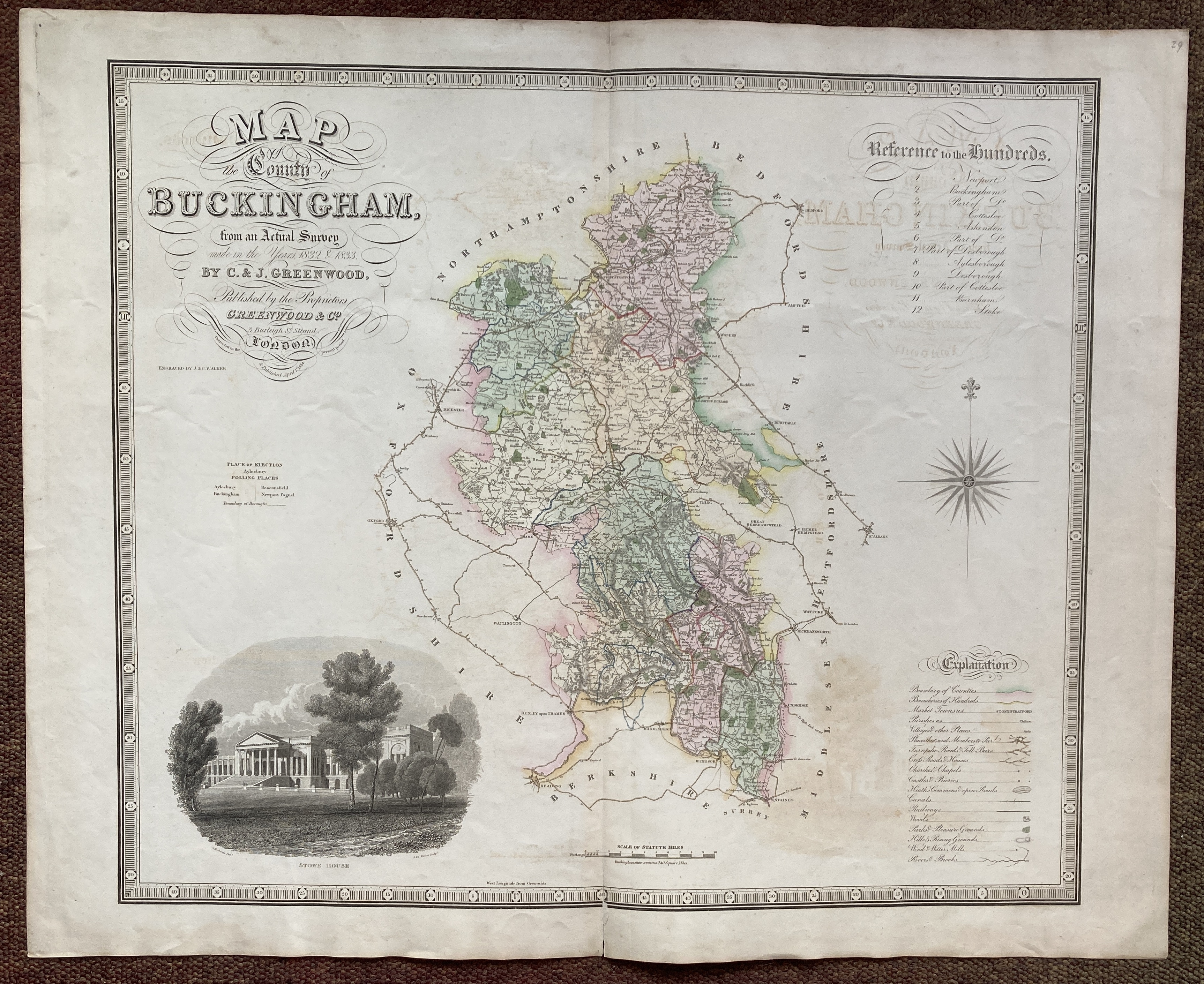
13229. C & J. Greenwood. MAP OF THE COUNTY OF BUCKINGHAM FROM AN ACTUAL SURVEY MADE IN THE YEARS, 1832 & 1833.1834, engraved by J. & C. Walker, plate size 765mm x 630mm, piano key border, ornamental engraved title and key, engraved vignette of Stowe House after G. Richards, hand- colouring. Some off setting, otherwise very good. 250.00 pounds.
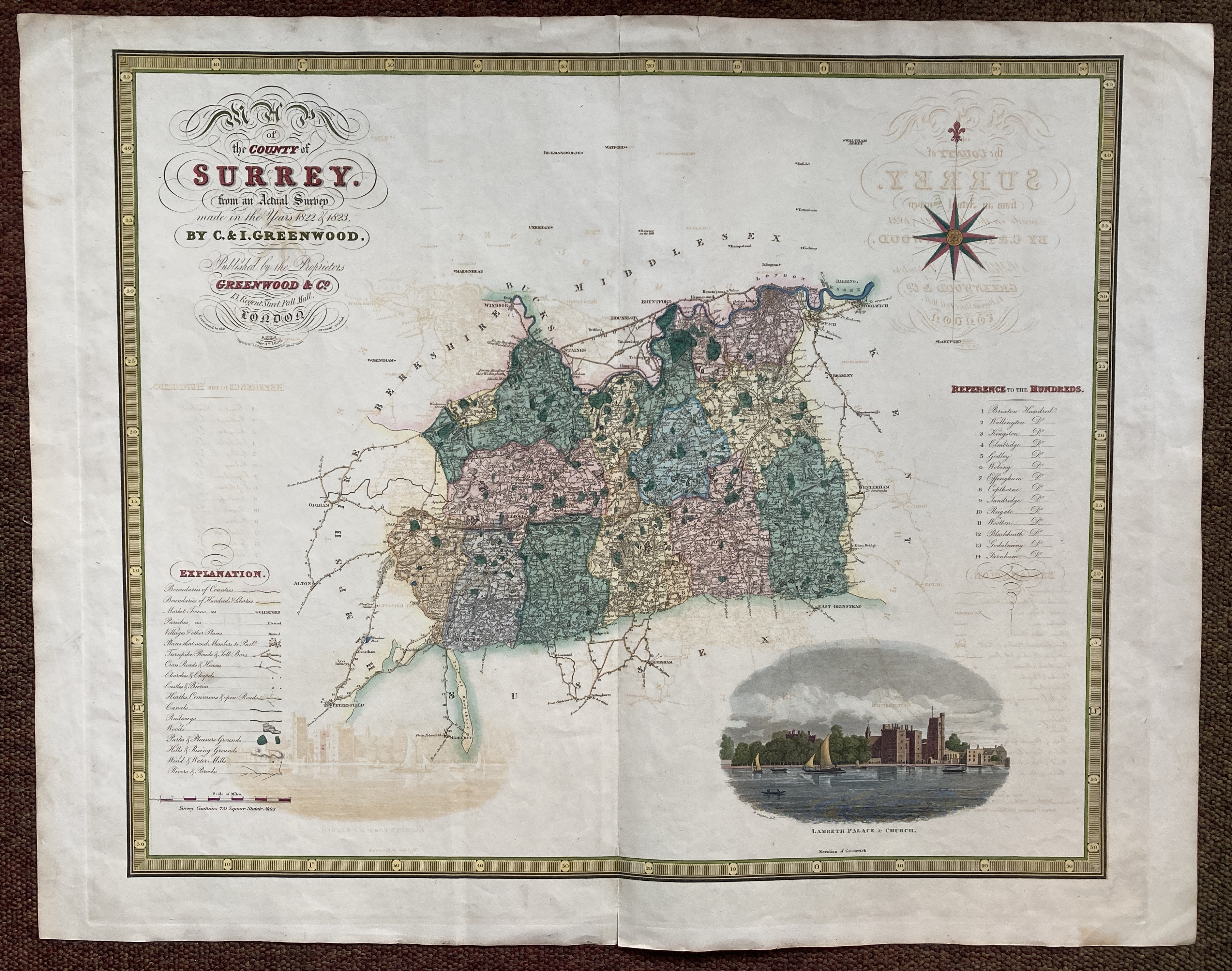
13230. C & J. Greenwood. MAP OF THE COUNTY OF SURREY FROM AN ACTUAL SURVEY MADE IN THE YEARS, 1822 & 1823. 1829, engraved by J. & C. Walker, plate size 765mm x 630mm, piano key border, ornamental engraved title and key, engraved vignette of Lambeth Palace and Church after R. Creighton, hand- colouring. Some off setting, otherwise very good. 300.00 pounds.
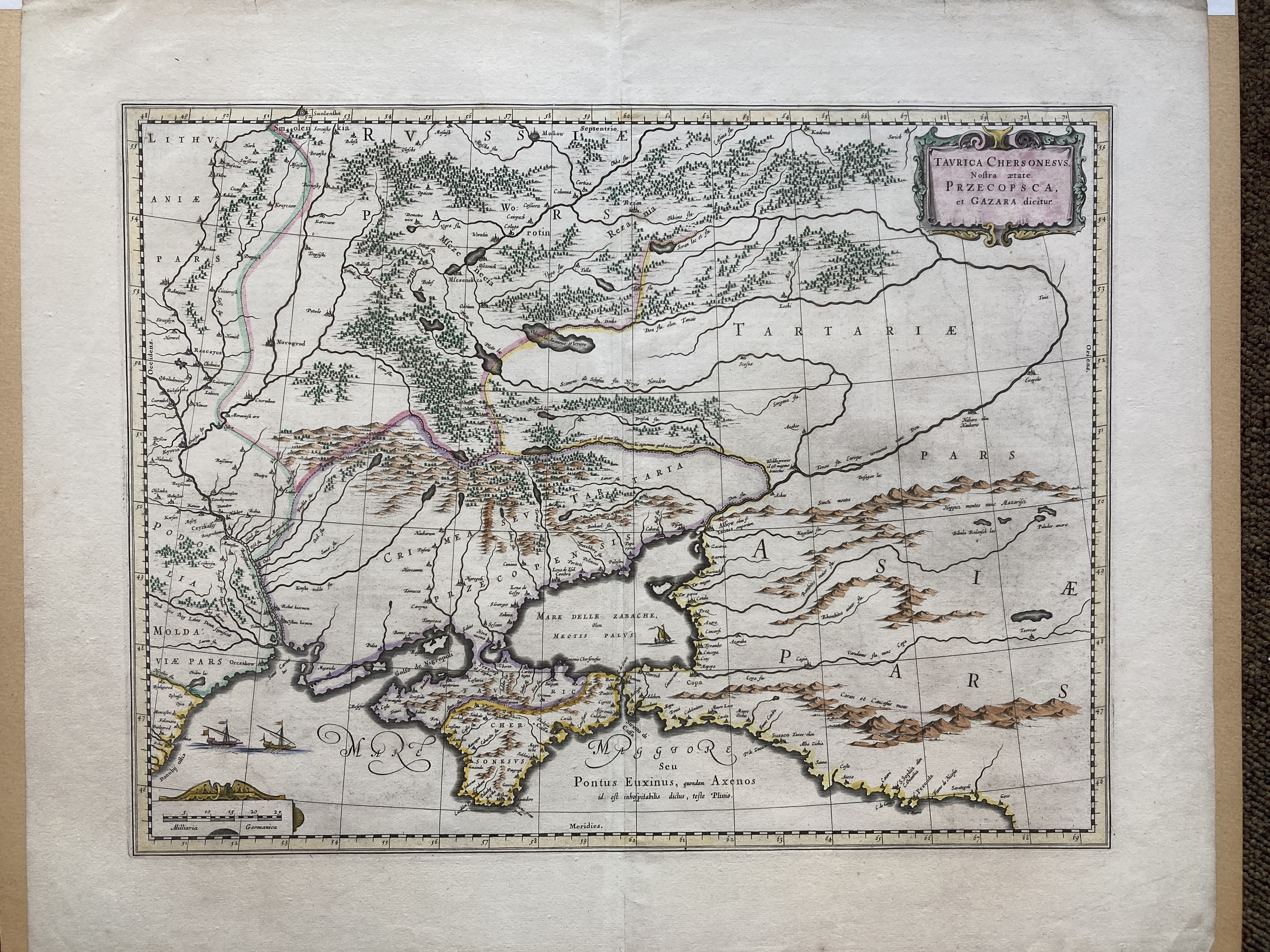
13231. William Blaeu. TAURIACA CHERSONESUS NOSTRA AETATE PRZECOPSCA, ET GAZARA DICITUR. Circa 1650, engraved map, plate size 500mm x 380mm, hand-coloured, German text on verso. Very good. 400.00 pounds.
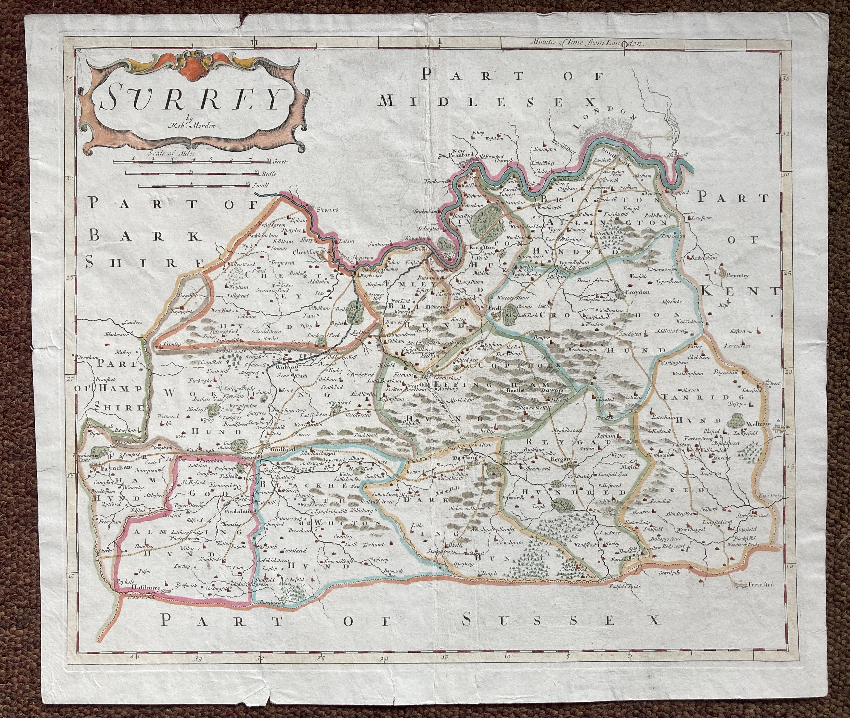
13232. Robert Morden. SURREY. No date, circa 1715, from the re-issue of Camden's Britannia, size 460mm x 395mm, hand coloured. A few short tears affecting only the margins, otherwise very good. 200.00 pounds.
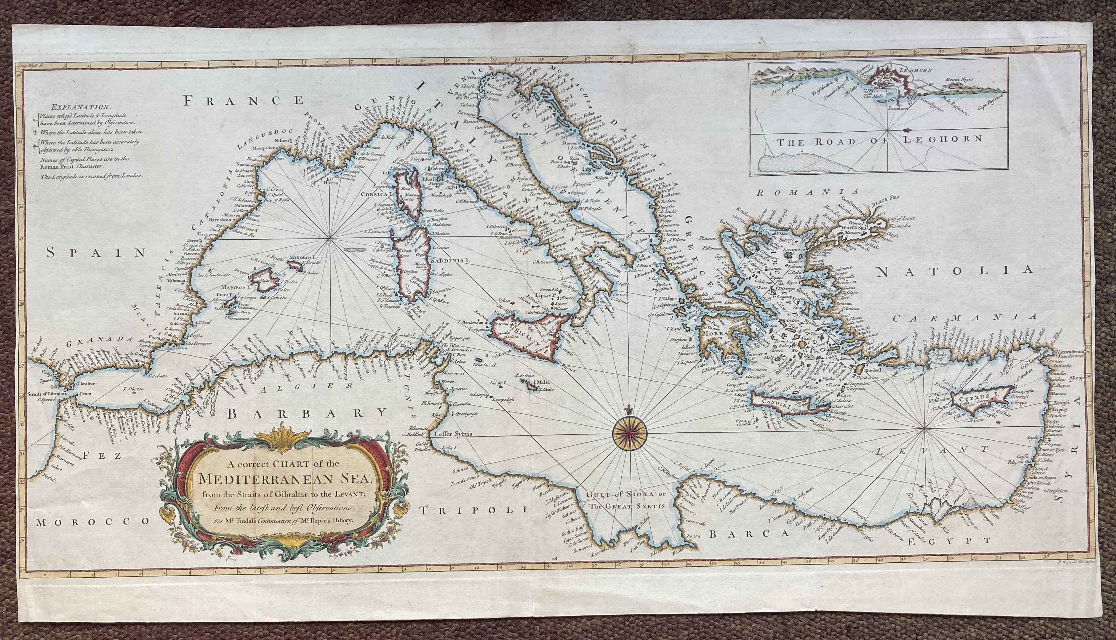
13236. R. W. Seale. A CORRECT CHART OF THE MEDITERRANEAN SEA, FROM THE STRAITS OF GIBRALTAR TO THE LEVANT; FROM THE LATEST AND BEST OBSERVATIONS: FOR MR. TINDAL'S CONTINUATION OF MR. RAPIN'S HISTORY. Circa 1750, size 725mm x 395mm, hand coloured, ornamental compass, ornamental title cartouche with inset plan of the Road of Leghorn. Slightly creased and fairly closely cropped to the left and right borders, otherwise a very good copy of a very decorative map. 500.00 pounds.
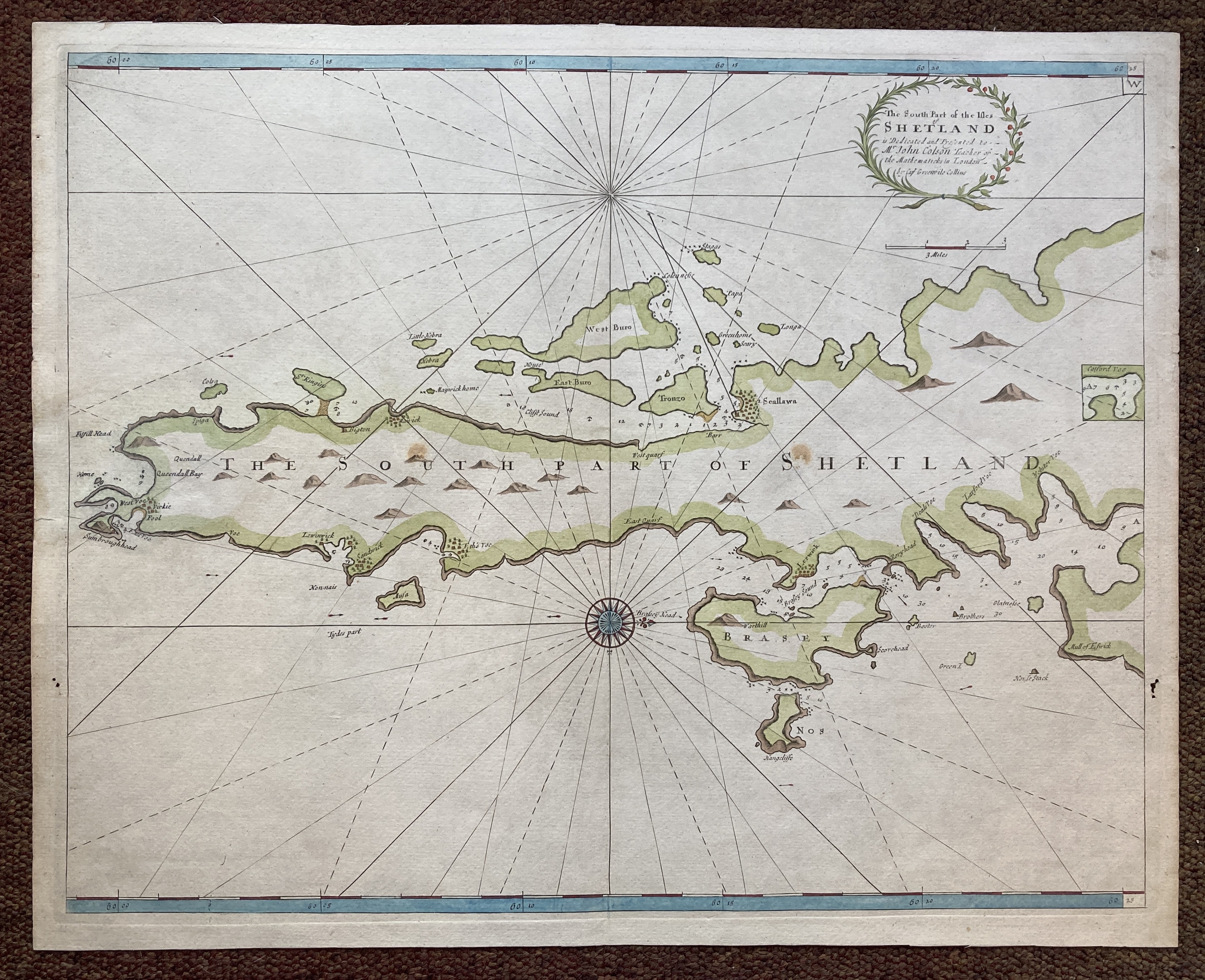
13238. Greenville Collins. THE SOUTH PART OF THE ISLES OF SHETLAND IS DEDICATED AND PRESENTED TO MR. JOHN COLSON TEACHER OF THE MATHEMATICKS IN LONDON. Circa 1720, size 600mm x 480mm, hand coloured, ornamental compass, and title cartouche. Small worm hole in margin, otherwise very good. 400.00 pounds.
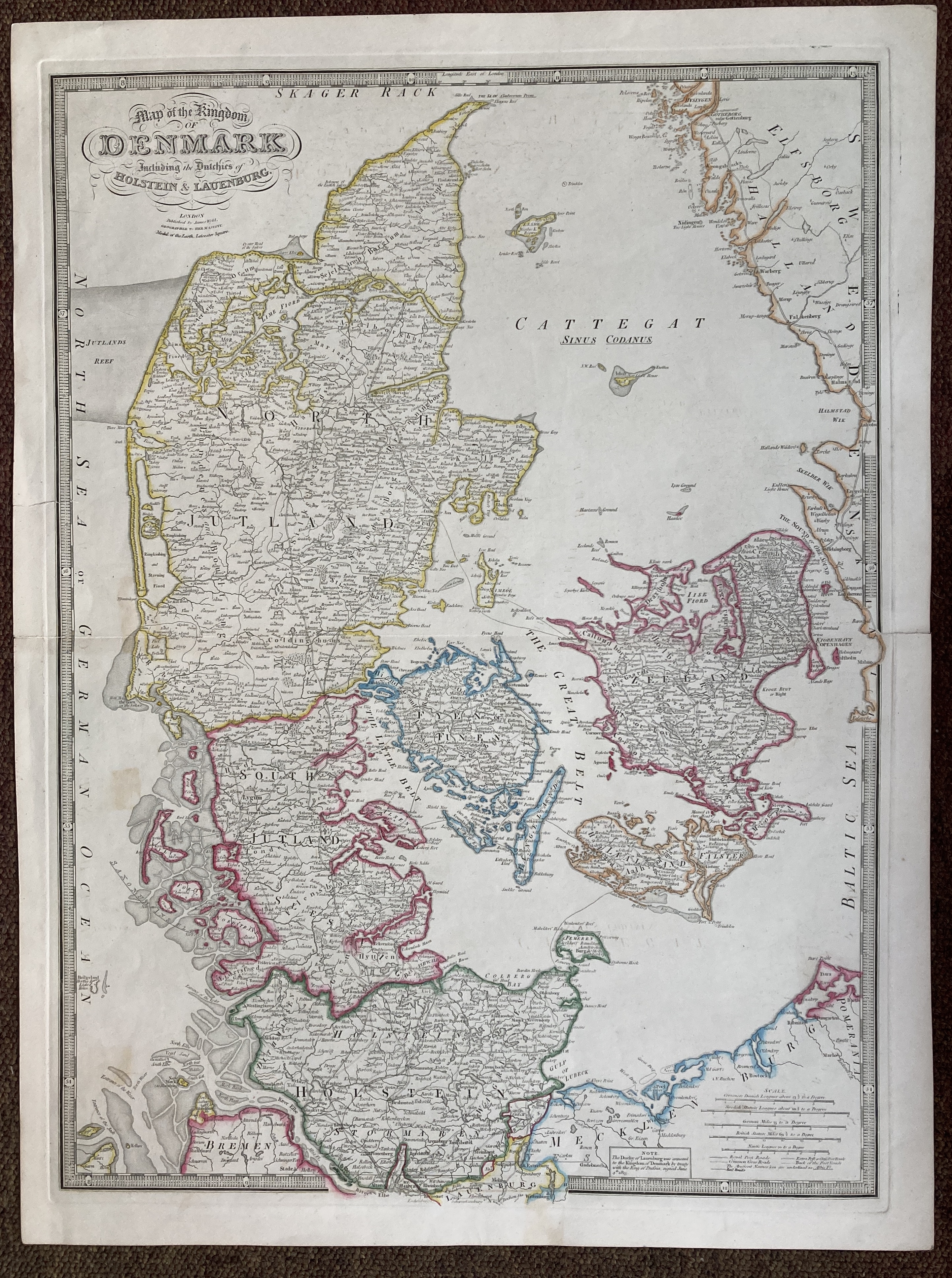
13239. James Wyld. MAP OF THE KINGDOM OF DENMARK. INCLUDING THE DUTCHIES OF HOLSTEIN AND LAUENBURG. Circa 1850, London, Published by James Wyld, Geographer to Her Majesty, Model of the Earth, Leicester Square, size 582mm x 780mm, hand coloured, ornamental engraved title, piano key border. Short closed tear, half an inch into the map, otherwise very good. 200.00 pounds.
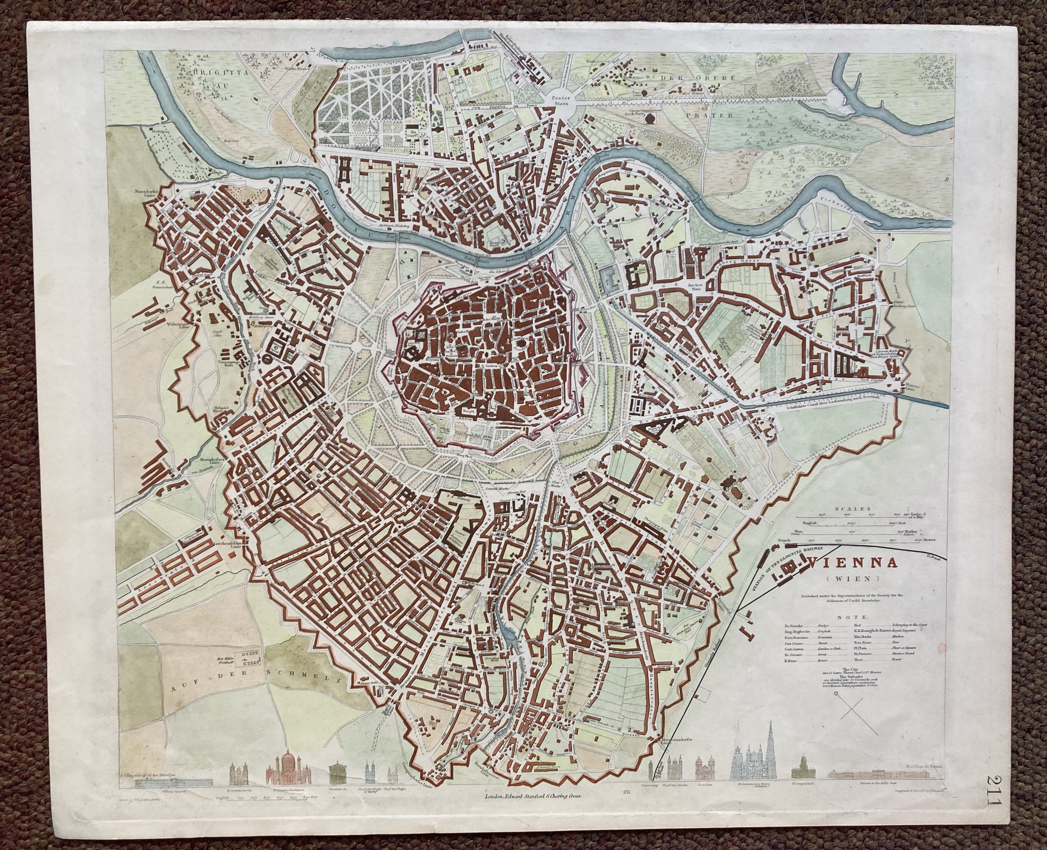
13240. W. B. Clarke. VIENNA. (WIEN). Circa 1833, published under the superintendence of the Society for the Diffusion of Useful Knowledge, engraved and printed by J. Henshall, size 430mm x 360mm, hand coloured, attractive town plan with important buildings in profile along the lower edge. Very good. 175.00 pounds.
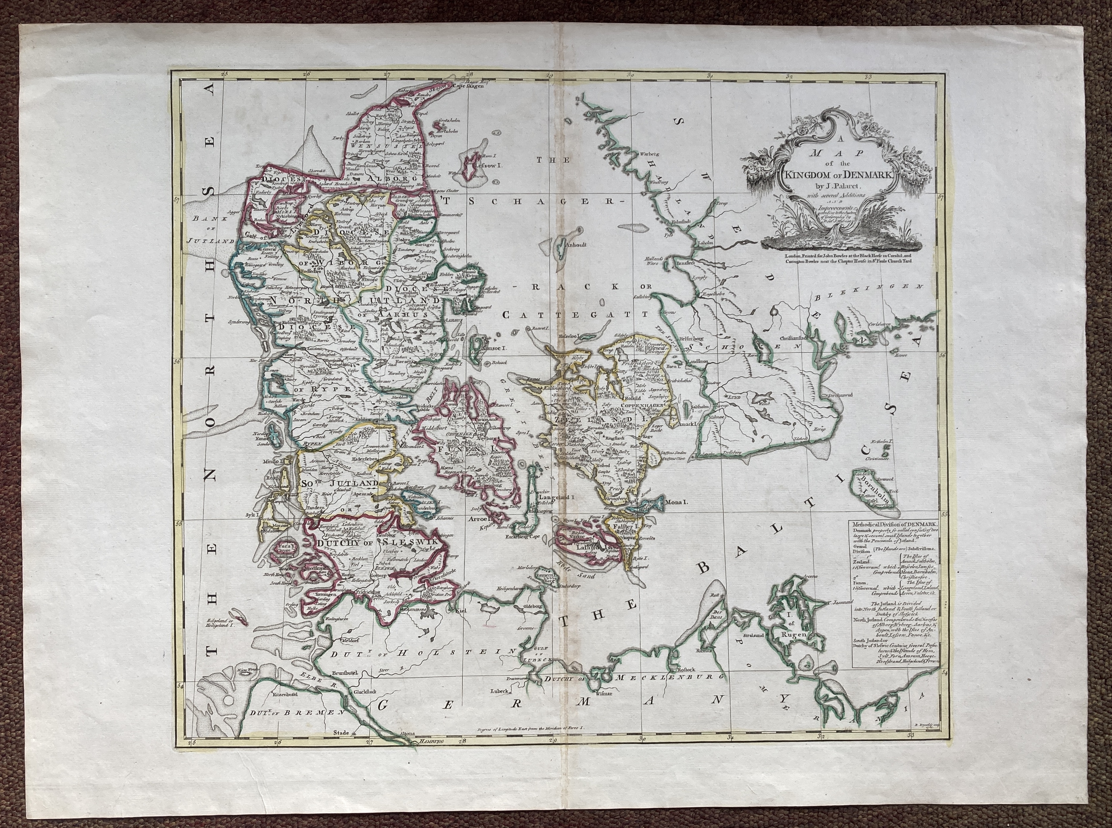
13241. J. Palaret. A MAP OF THE KINGDOM OF DENMARK, WITH SEVERAL ADDITIONS AND IMPROVEMENTS ACCORDING TO THE SYSTEM OF GEOGRAPHY BY DOCTOR J. HUBNER. 1760, London, printed for John Bowles, at the Black Horse in Cornhil, and Carrington Bowles, next the Chapter House in St. Paul's Church Yard, engraved by R. Reynold, size 750mm x 550mm, hand coloured, ornamental title. Slight discolouration on centre fold, otherwise very good. 250.00 pounds.
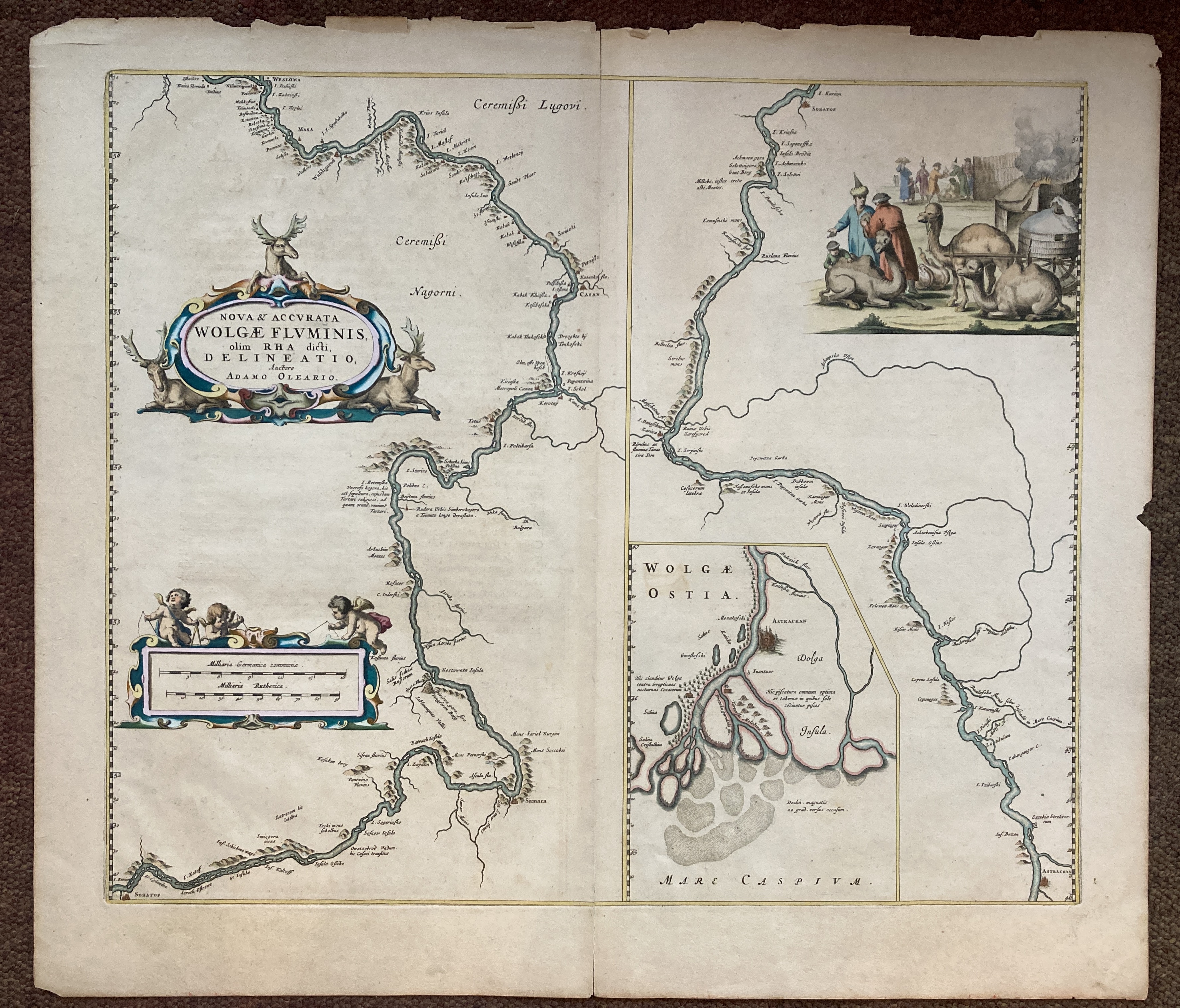
13242. [William Blaeu]. NOVA &. ACCURATA WOLGAE FLUMINIS, OLIM RHA DICTI DELINEATIO, AUCTORE ADAMO OLEARIO. 1662, size 645mm x 560mm, hand coloured, ornamental cartouche, ornamental mileage scale with cherubs, inset map of the estuary around Astrachan, inset image of merchants trading around a campfire, latin text on verso. Edges slightly frayed, otherwise very good. 1500.00 pounds.
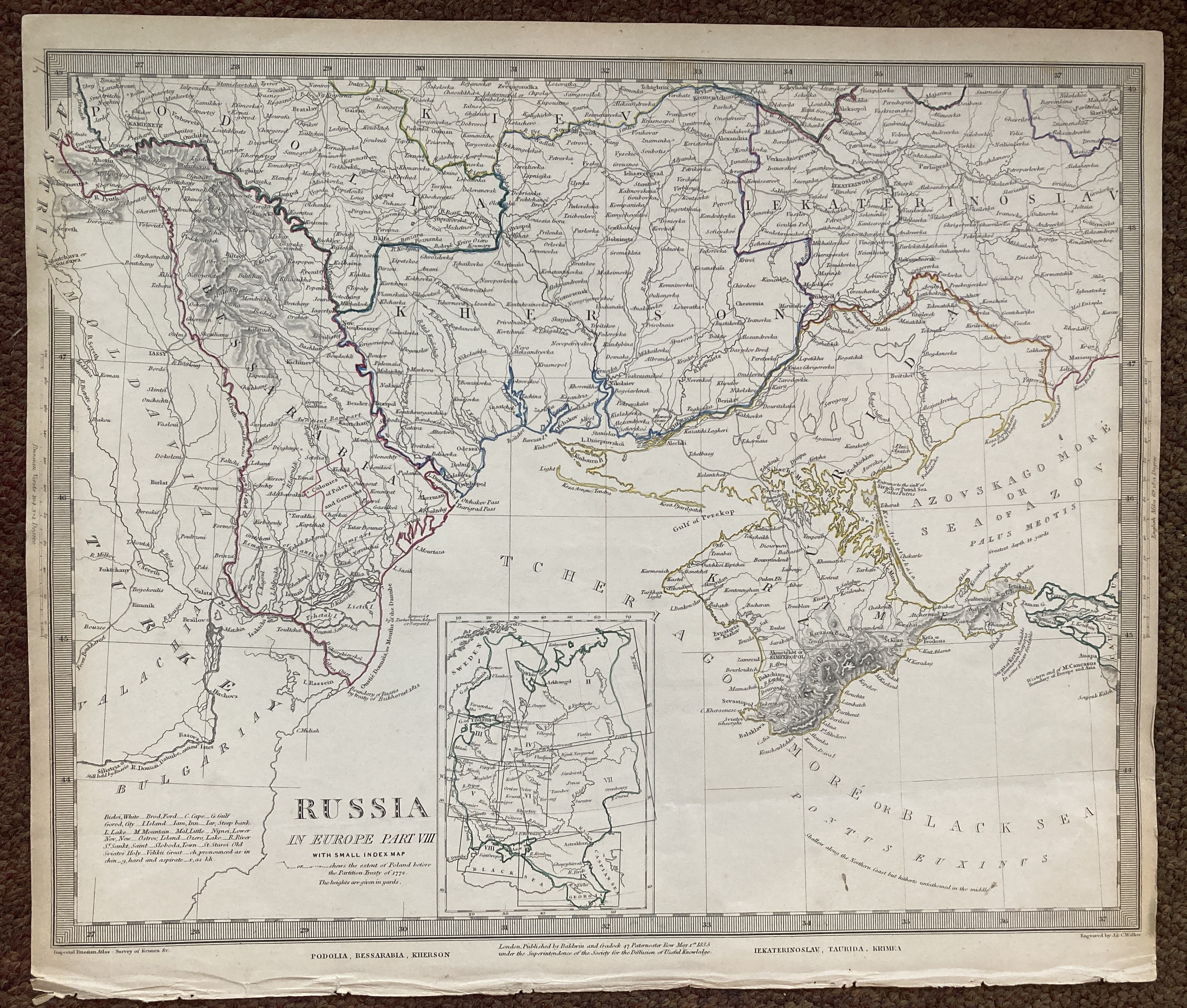
13243. J. & C. Walker. RUSSIA IN EUROPE PART VIII, WITH SMALL INDEX MAP ...OR...SHEWS THE EXTENT OF POLAND BEFORE THE PARTITION TREATY OF 1772. 1835, London, published by Baldwin & Cradock, under the superintendence of the Society for the Diffusion of Useful Knowledge, size 410mm x 350mm, hand coloured outline. Edges slightly browned, otherwise very good. 75.00 pounds.
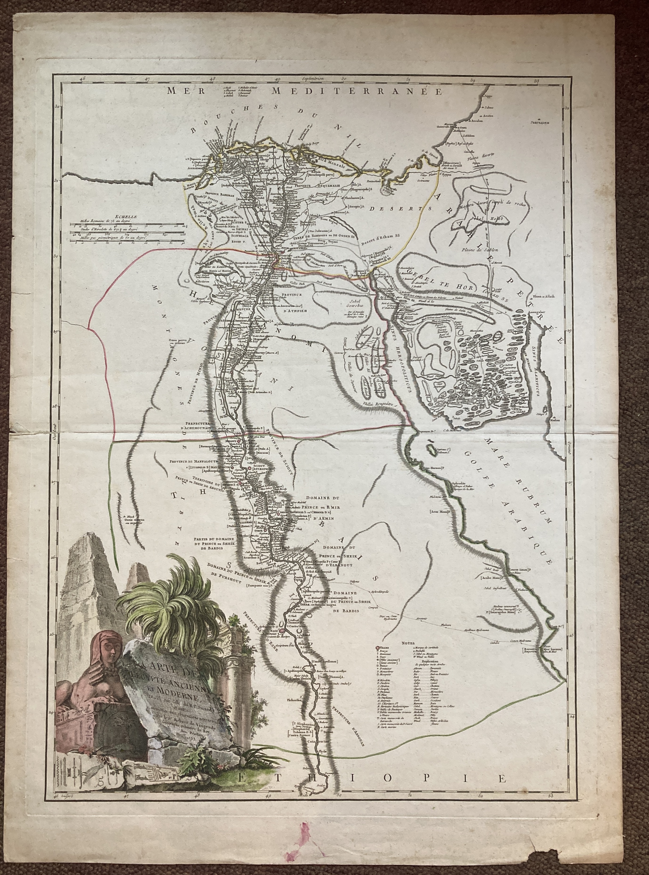
13244. Robert de Vaugondy. CARTE DE L'EGYPTE ANCIENNE ET MODERNE, DRESSEE SUR CETTE DU R. P. SICKARD ET AUTRES. Circa 1753, size 535mm x 745mm, hand coloured, engraved cartouche by Haussard, featuring a sphinx, pyramids, ruins and palm trees. A little worn in the margins, otherwise very good. 300.00 pounds.
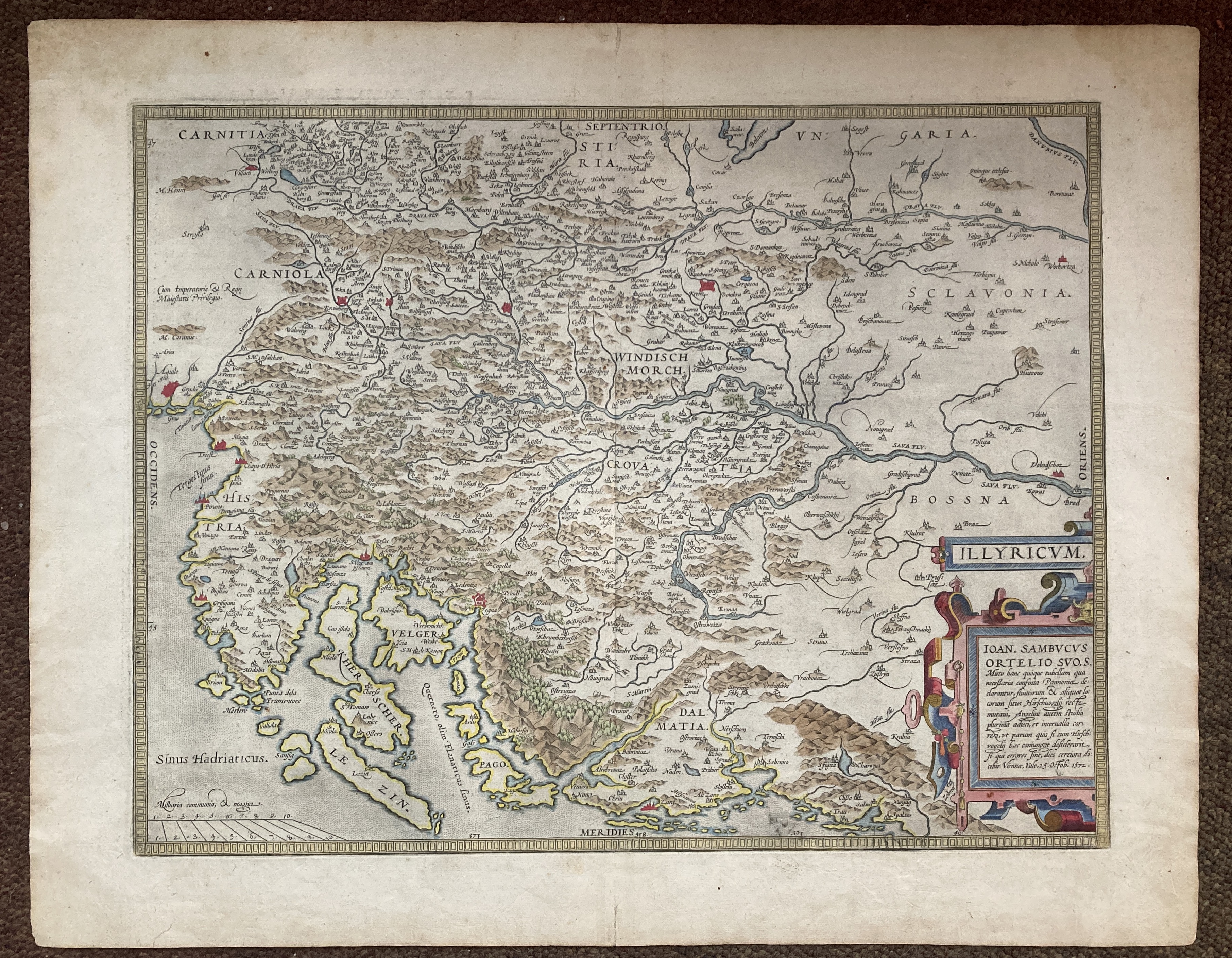
13245. Abraham Ortelius. ILLYRICUM. 1572, Antwerp, size 570mm x 455mm, hand coloured, ornamental title and cartouche. Very good. 600.00 pounds.
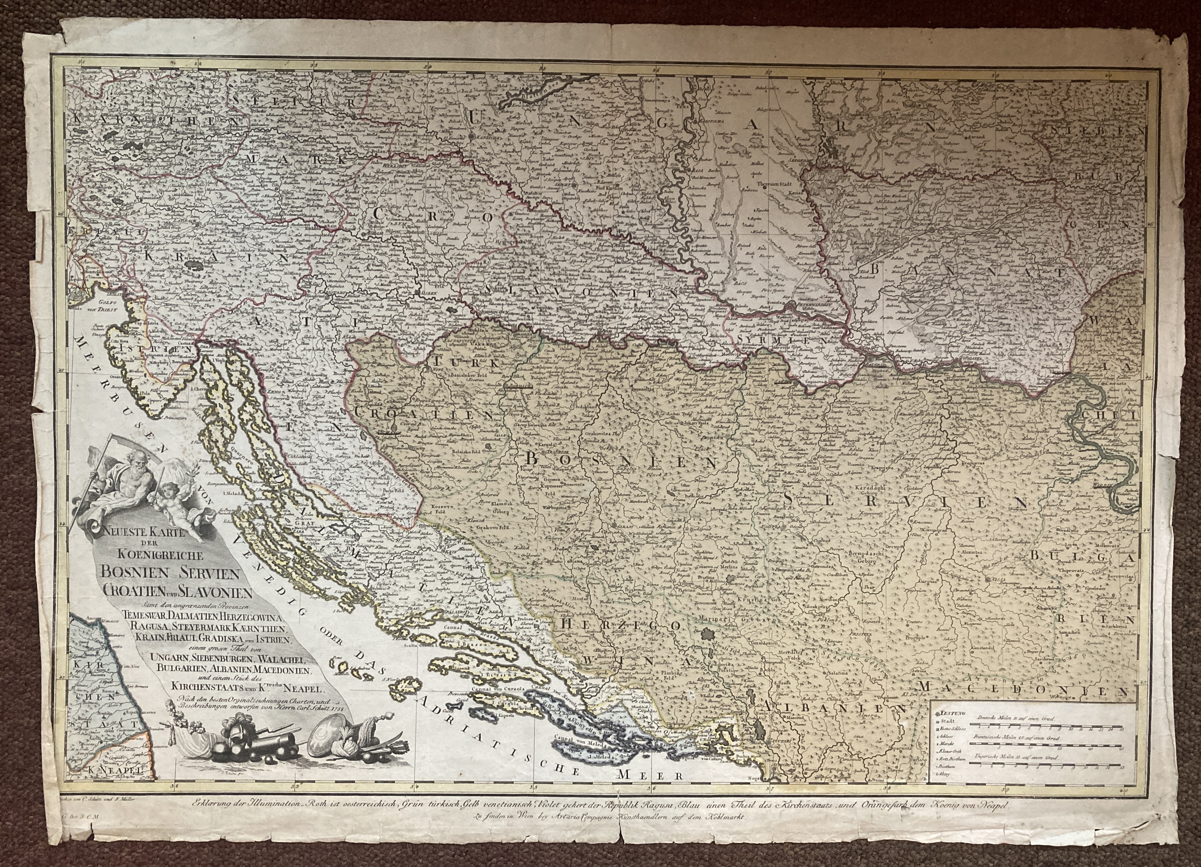
13246. Carl Shutz. NEUESTE KARTE DER KOENIGREICHE BOSNIEN SERVIEN CROATIEN UND SLAVONIEN SAMT DEN ANGROENZENDEN PROVINZEN TEMESWAR, DALMATIEN, HERZEGOWINA, RAGUSA, STEYERMARK, KAERNTHEN, KRAIN, FRIAUL, GRADISKA UND ISTRIEN, EINEM GROSEN THEIL VON UNGARN, SIEBENBURGEN, WALACHEI, BULGARIEN, ALBANIEN MACEDONIEN UND EINEM STUCK DES KIRCHENSTAATS UND KREICHS NEAPEL. 1788, Vienna, size 755mm x 540mm, hand coloured, ornamental engraved cartouche title. Margins creased and chipped with some closed tears, otherwise good. 500.00 pounds.
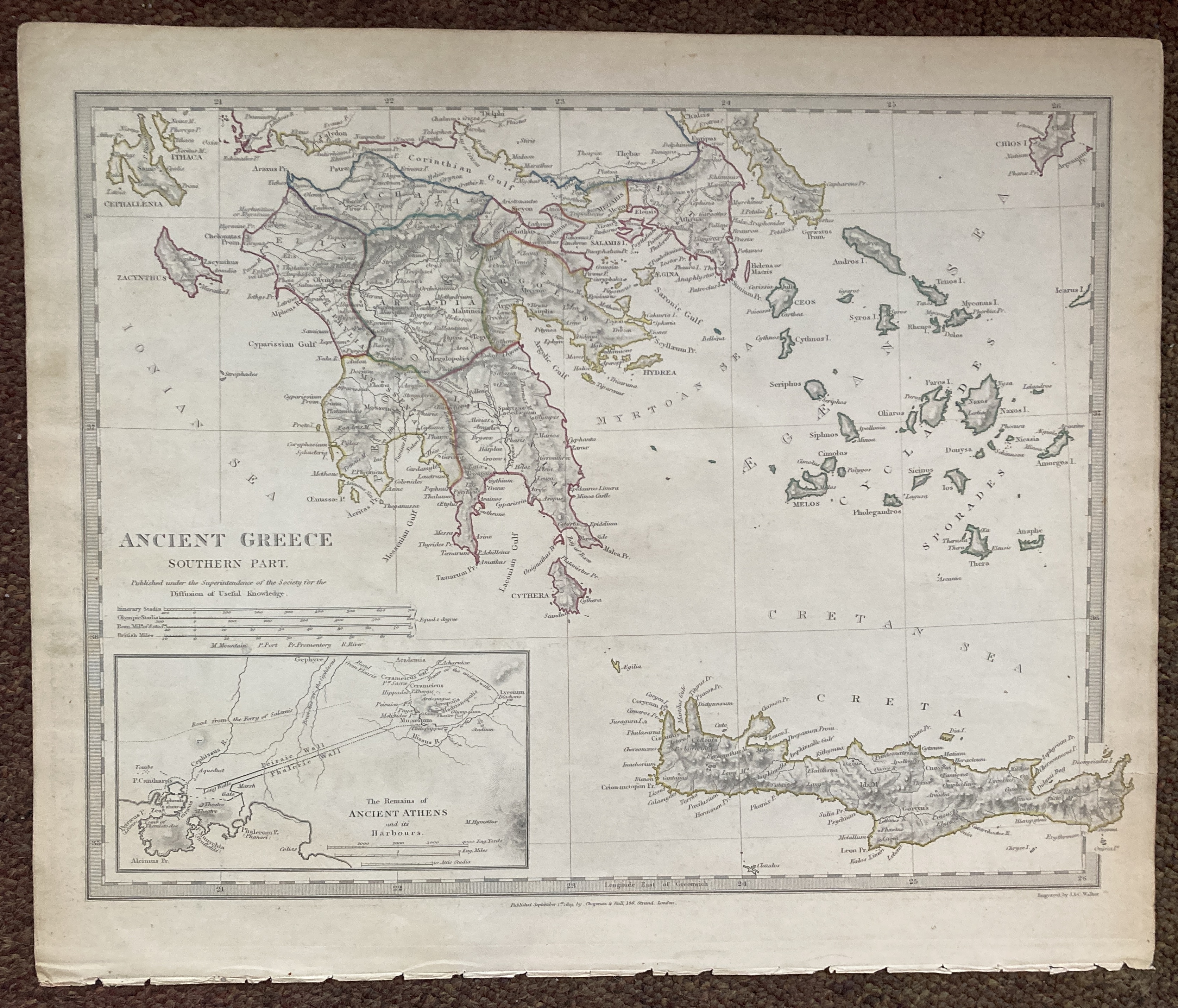
13247. J. & C. Walker. ANCIENT GREECE. SOUTHERN PART. 1829, published by Chapman & Hall, under the superintendence of the Society for the Diffusion of Useful Knowledge, size 410mm x 340mm, hand coloured outline, inset plan of the remains of ancient Athens and its harbours, piano key border. A little browned, otherwise very good. 75.00 pounds.
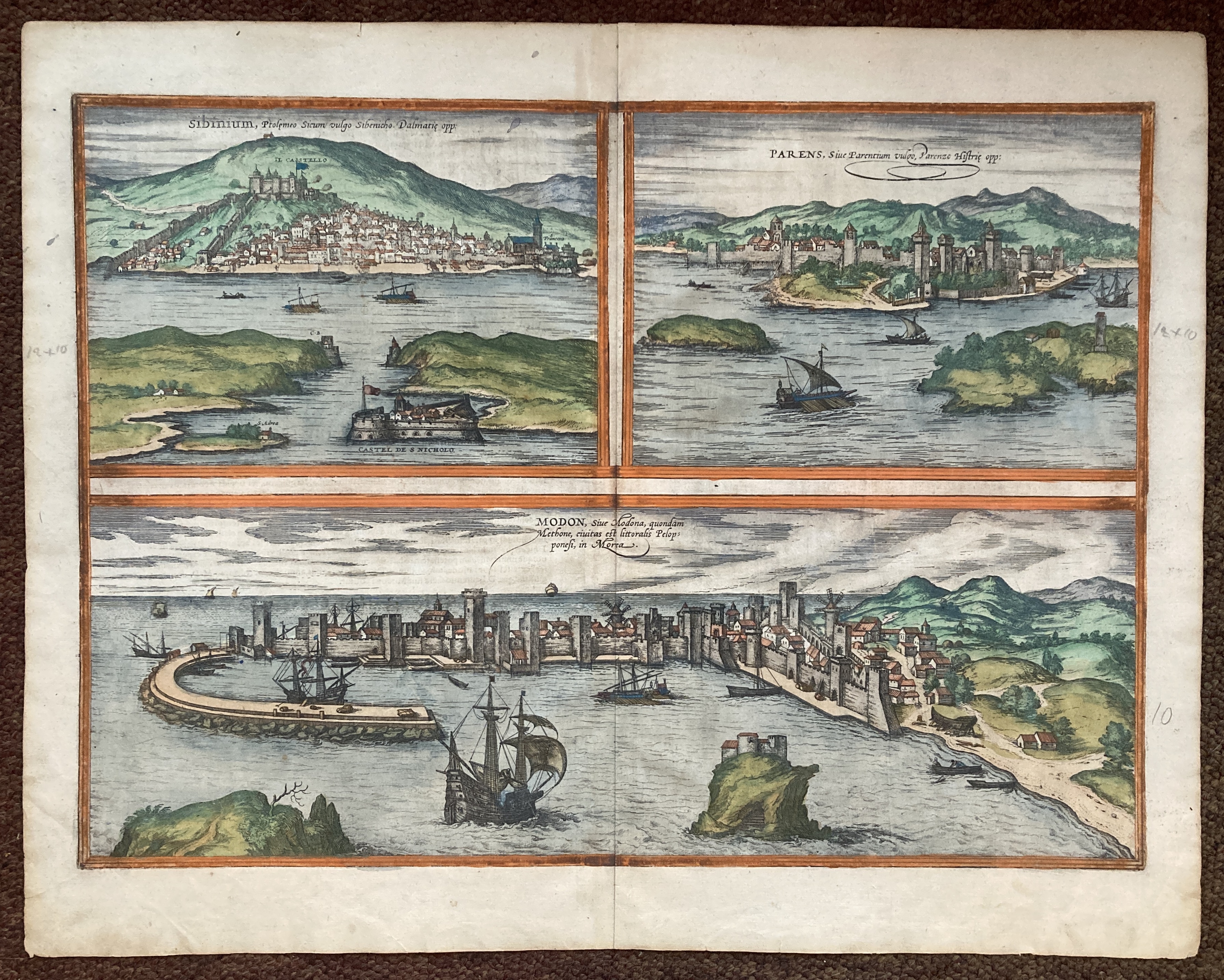
13248. Braun & Hogenberg. SEBENICO. PARENS. MODONA. 1572, Cologne, size 540mm x 425mm, beautifully hand coloured, possibly contemporary, latin text on verso. Very good. 600.00 pounds.
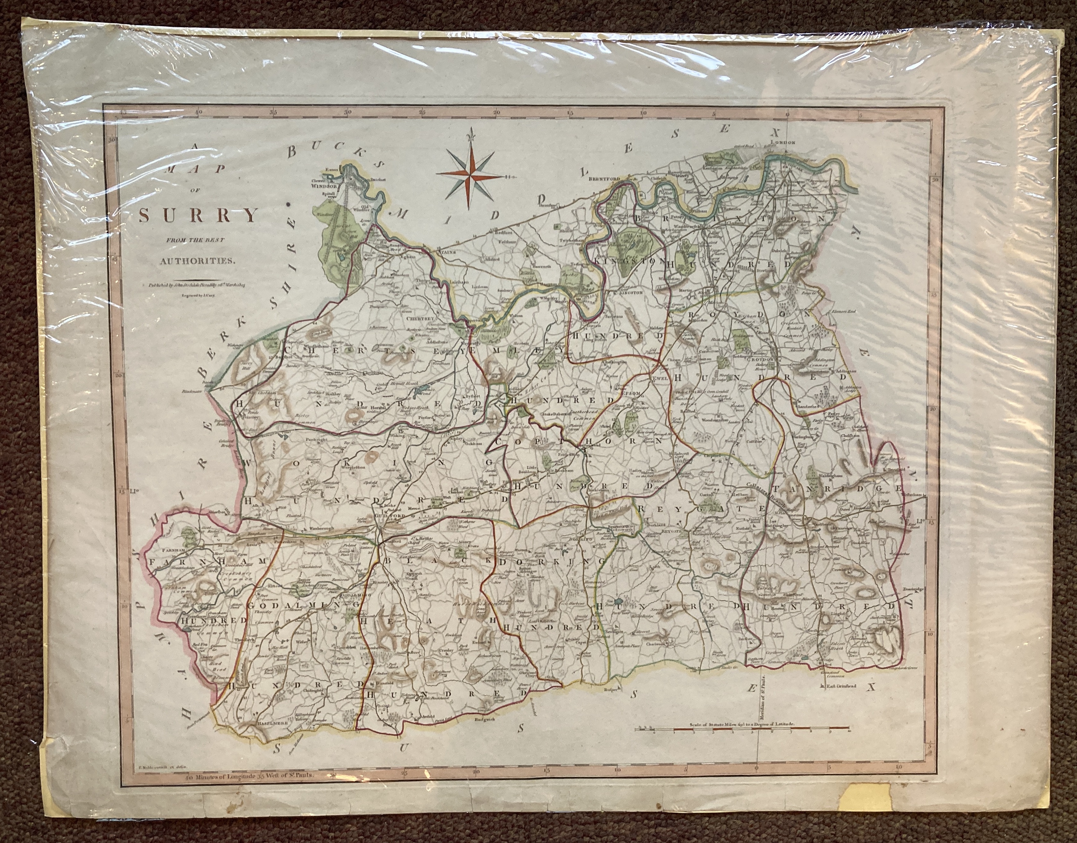
13249. J. Cary after F. Noble. A MAP OF SURRY FROM THE BEST AUTHORITIES. 1805, John Stockdale, Piccadilly, size 595mm x 460mm, hand coloured. Chipped and torn in the lower margins, not affecting the image, otherwise very good. 200.00 pounds.
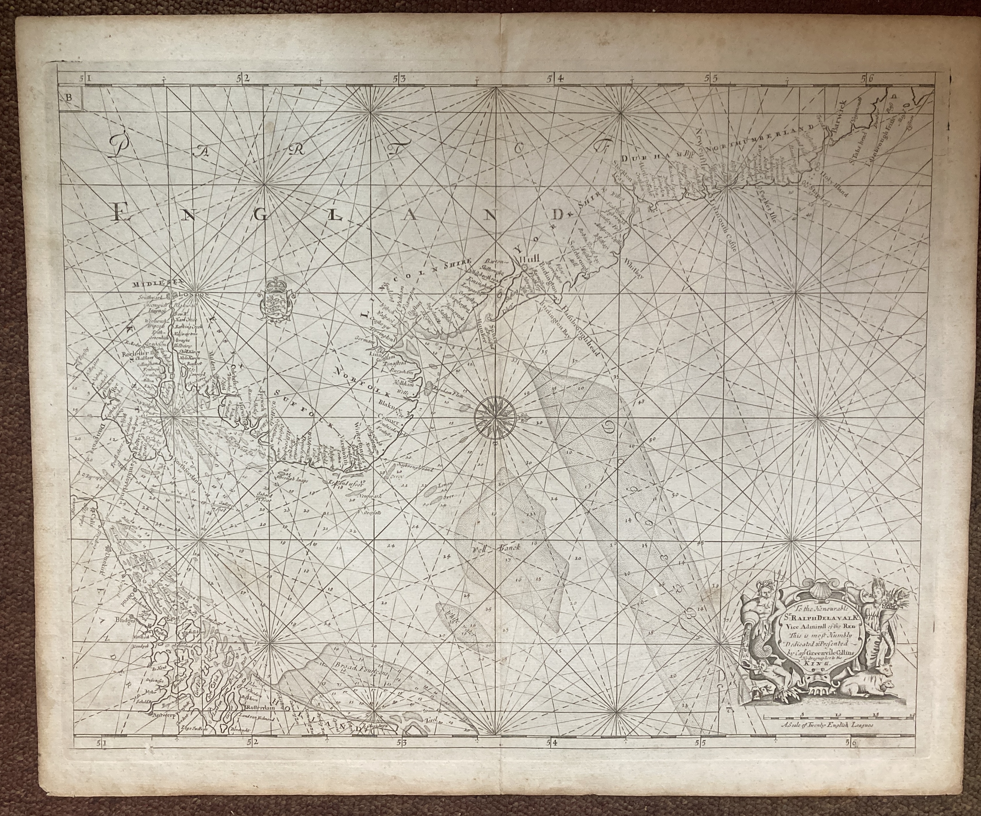
13250. Greenville Collins. THE THAMES AND NORTH SEA. Circa 1750, size 600mm x 480mm, uncoloured, ornamental compass, and title cartouche. Good. 275.00 pounds.
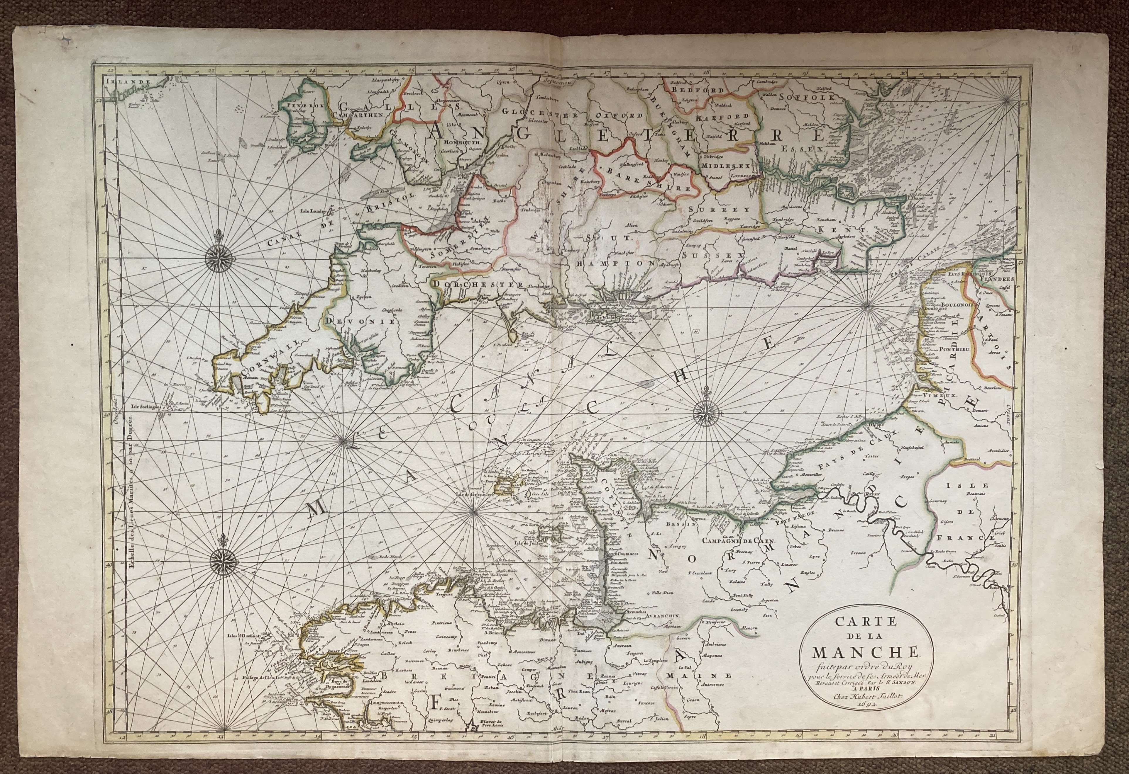
13251. Alexis-Hubert Jaillot. Sanson. Pieter Mortier. CARTE DE LA MANCHE. FAITE PAR ORDRE DU ROY POUR LE SERVICE DE LES ARMÉES DE MER. REVUE ET CORRIGÉE PAR LE SR. SANSON. A PARIS. 1692, (Amsterdam), engraved map 580mm x 805mm, two sheets joined, hand-coloured. A fine impression with good, early colouring. The Sansons worked in partnership with Jaillot to publish the Atlas Nouveau but before publication fell into disagreement. Jaillot then formed a partnership with Pieter Mortier in Amsterdam and published their Dutch atlas using the older plates, all bearing the Paris imprint, sometimes dated 1692. Some foxing and repairs to the centre-fold, a couple of small wormholes in the margin, otherwise a very attractive map. 400.00 pounds.
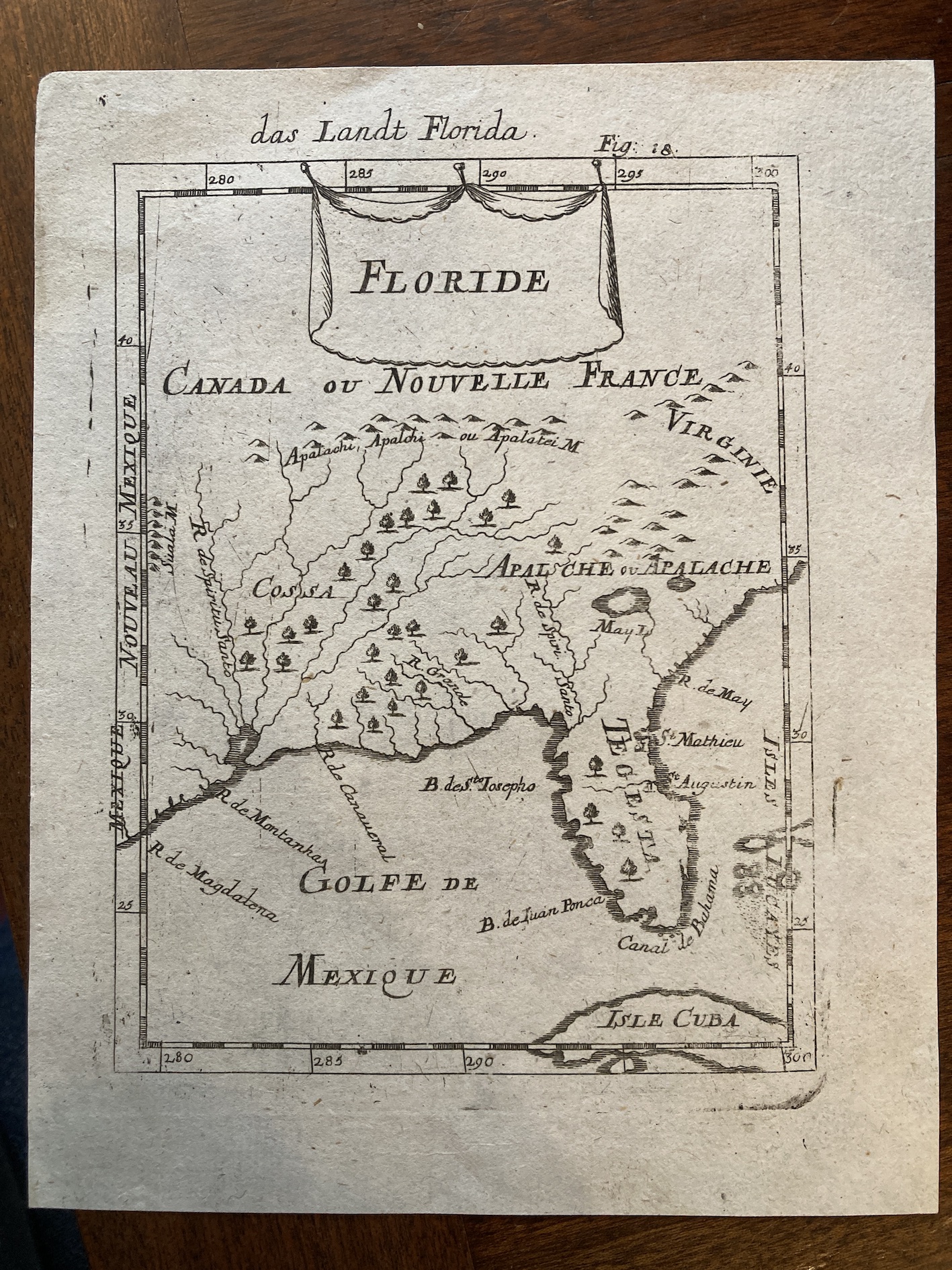
13252. Alain Manesson Mallet. FLORIDE. DAS LANDT FLORIDA FIG.18. No date, circa 1686, Frankfurt, from "Description de L'Univers, Contenant les Differentes Systemes du Monde", 15cm x 19cm, uncoloured. Very good. 200.00 pounds.
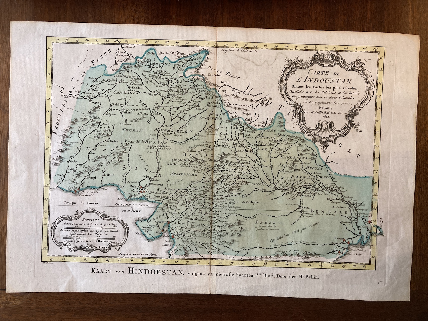
13253. M. Bellin. CARTE DE L'INDOUSTAN. SUIVANT LES CARTES LES PLUS RÉCENTES, CONCILIÉES AVEC LES RELATIONS ET LES DÉTAILS GÉOGRAPHIQUES INSERÉS DANS L'HISTOIRE DES ESTABLISSEMENS EUROPEENS. IE. FEUILLE PAR M. BELLIN INGR. DE LA MARINE. 1752, Paris, text in French with Dutch title in the margin, 40cm x 27cm, colour wash map. Very good. 100.00 pounds.
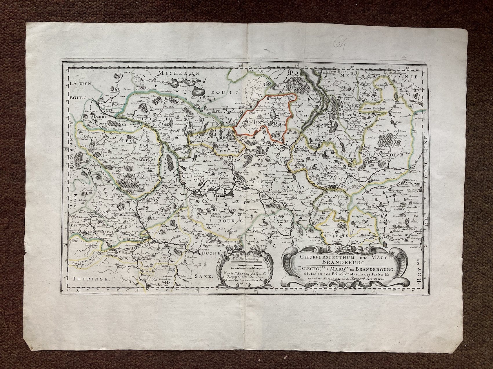
13254. Nicolas Sanson. CHURFURSTENTHUM, UND MARCH BRANDEBURG. 1654, Paris, 58cm x 43cm, hand-coloured outline. Very good. 250.00 pounds.
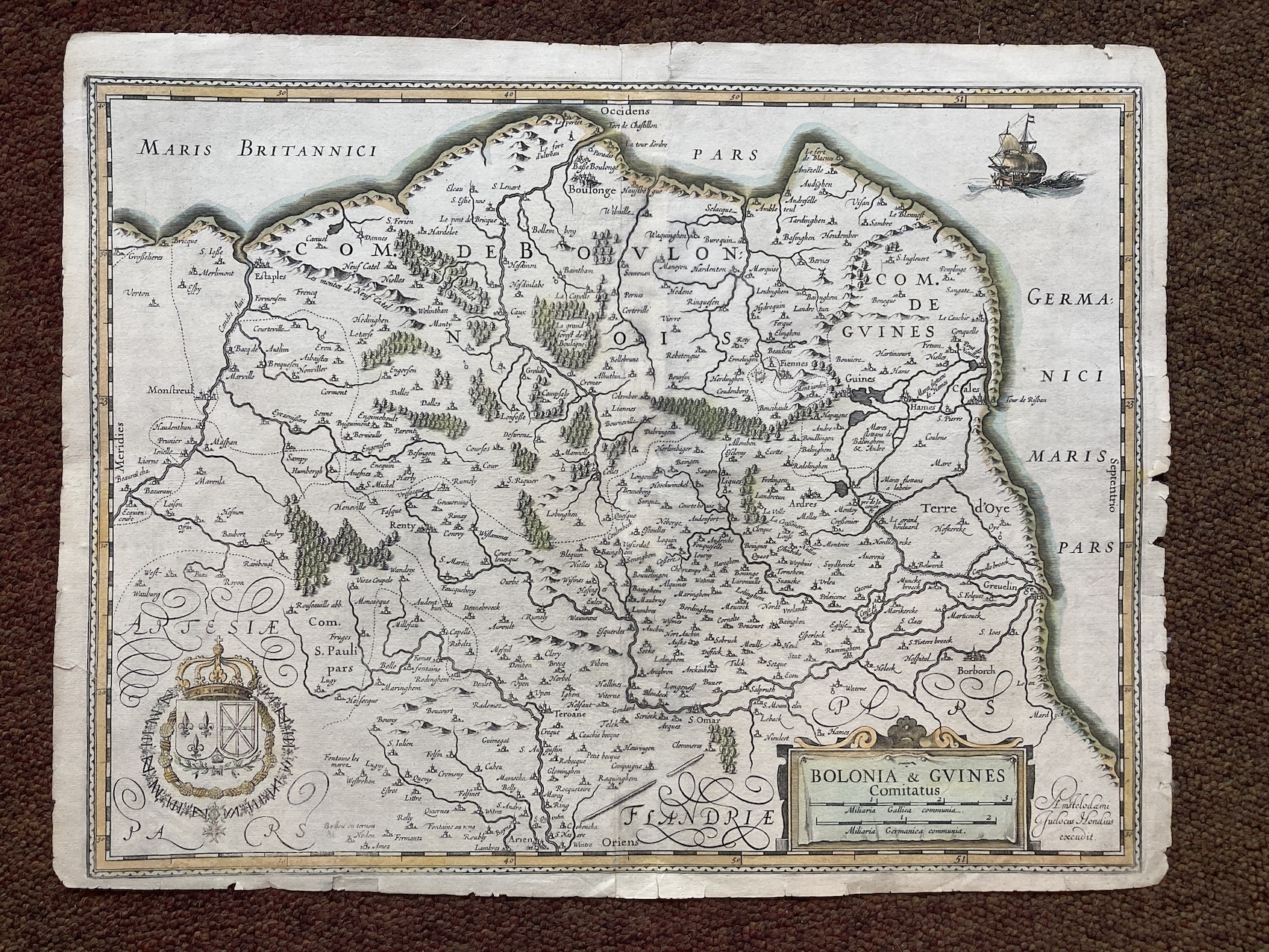
13255. Judocius Hondius. BOLONIA & GUINES COMITATUS. No date, circa 1630, 52cm x 40cm, hand-coloured outline. Slightly chipped around the edges, but not affecting the image, which is very good. 150.00 pounds.
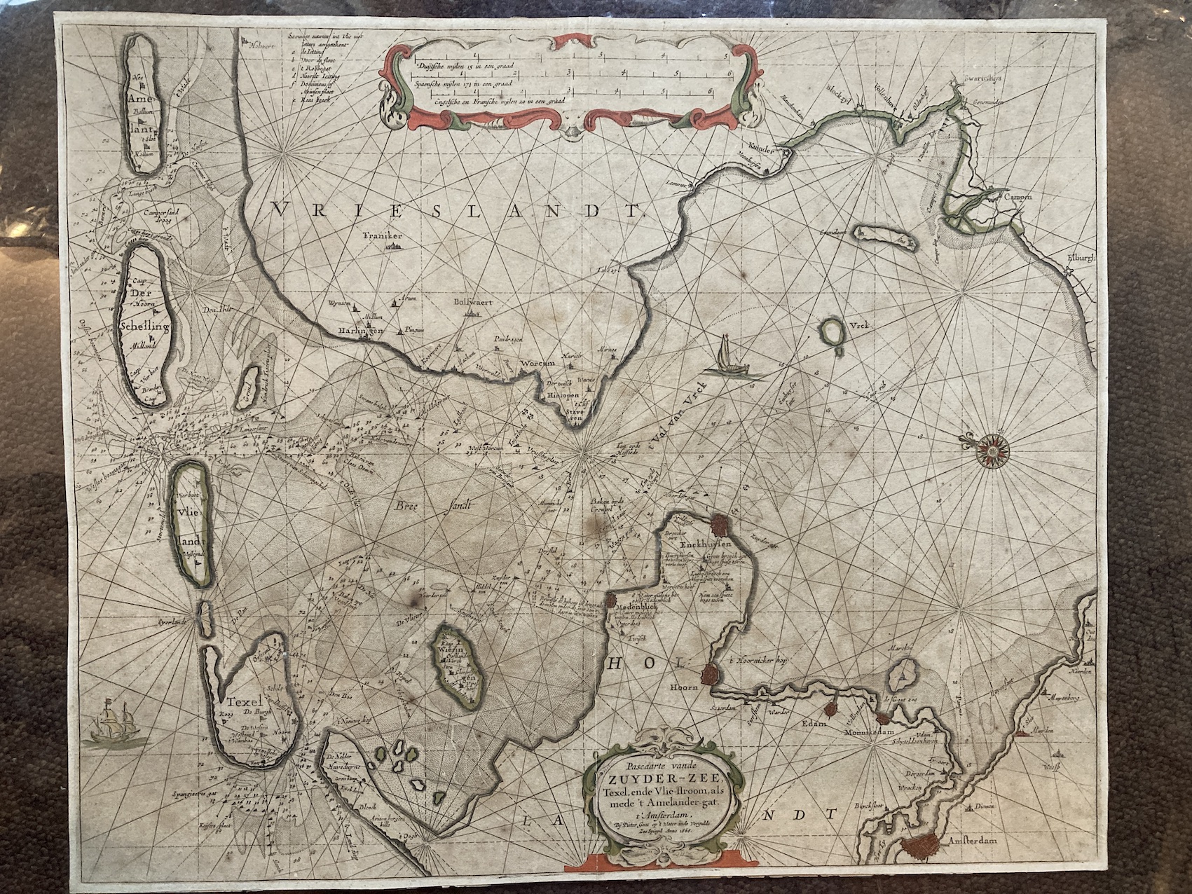
13256. Pieter Goos. PASCAARTE VANDE ZUYDER-ZEE. 1666, Amsterdam, 53cm x 43cm, hand-coloured map. Trimmed to the plate mark, slightly browned and neatly repaired on the centre fold. 500.00 pounds.
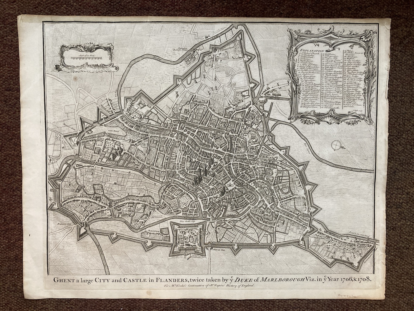
13257. J. Basire. GHENT A LARGE CITY AND CASTLE IN FLANDERS, TWICE TAKEN BY YE DUKE OF MARLBOROUGH VIS. IN YE YEAR 1706, & 1708. FOR MR. TINDAL'S CONTINUATION OF MR RAPIN'S HISTORY OF ENGLAND. 1758, London, 52cm x 40cm, uncoloured. Slightly chipped and browned in margin, otherwise very good. 150.00 pounds.
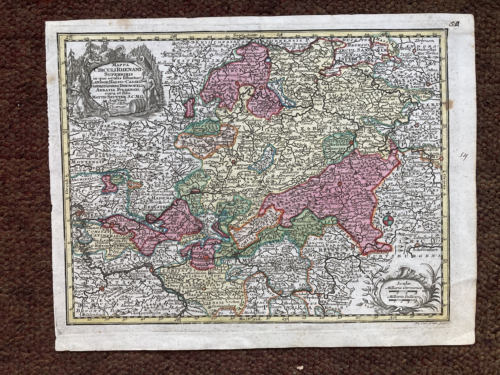
13258. Matthaus Seutter. CIRCULI RHENANI SUPERIORIS. 1744, Augsburg, 28cm x22cm, uncoloured. The 'small' version. Very good. 100.00 pounds.
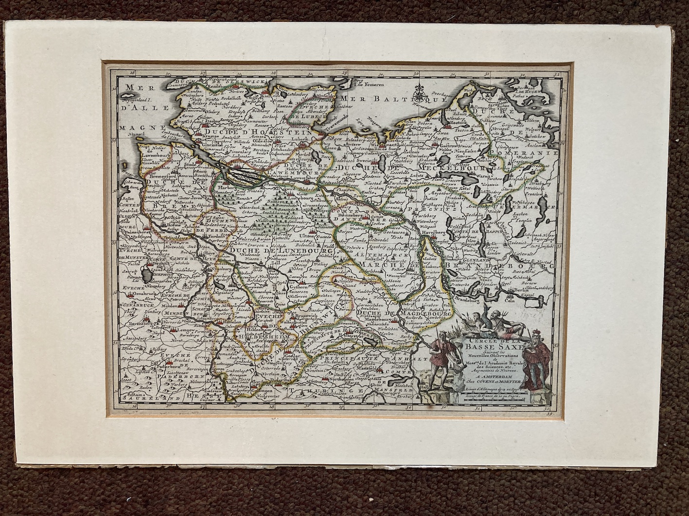
13259. Covens et Mortier. CERCLE DE LA BASSE SAXE. Circa 1740, Amsterdam, Covens et Mortier, 43cm x 29cm, hand-coloured. Attached to mount, otherwise very good. 100.00 pounds.
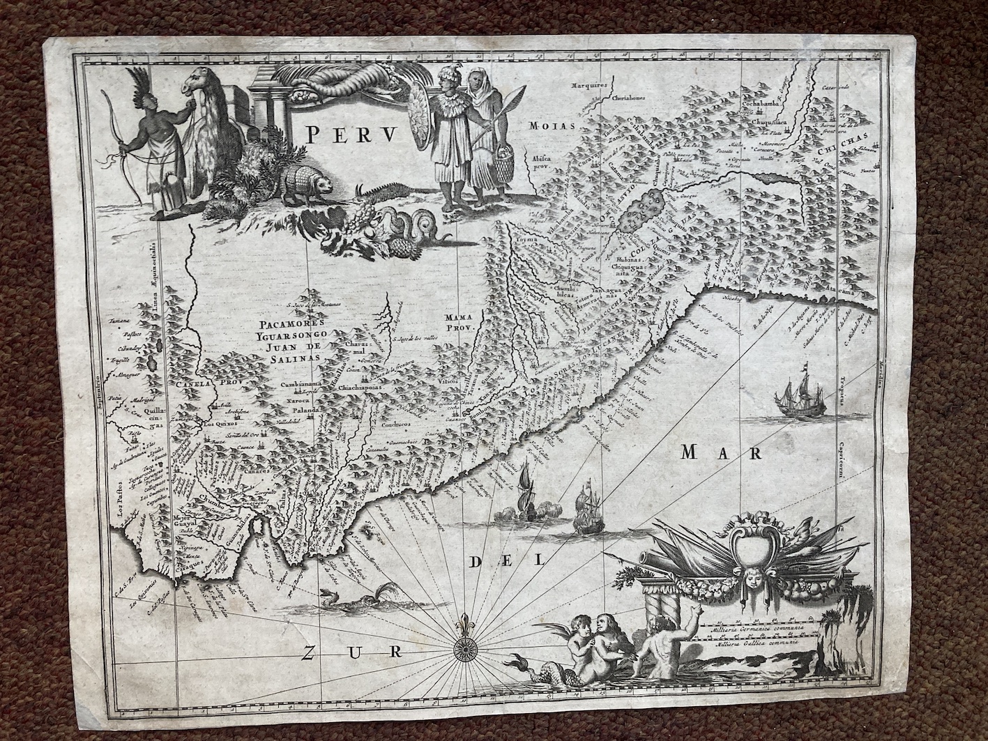
13261. Arnoldus Montanus. PERU. 1673, Jacob Meurs, Amsterdam, 38cm x 30cm, uncoloured. From "De Nieuwe en Onbekende Weereld", a classic book on America and much sought after by collectors of Americana". Minor repairs to margins, otherwise very good. 200.00 pounds.
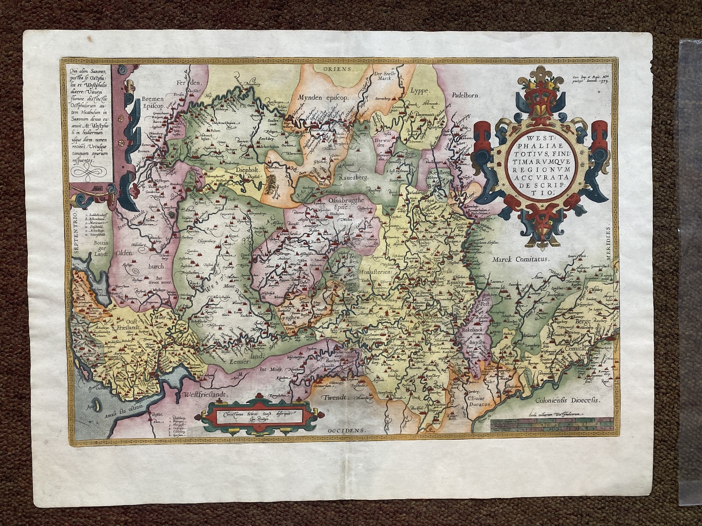
13262. Abraham Ortelius. WESTPHALIAE TOTIUS, FINITMARUMQUE REGIONUM ACCURATA DESCRIPTIO. 1579, Antwerp, 56cm x42cm, hand-coloured, Latin text on verso. Very good. 250.00 pounds.
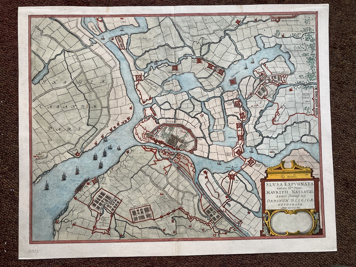
13263. Johannes Blaeu. SLUSA EXPUGNATA. No date, circa 1640, Amsterdam, 53cm x 43cm, hand-coloured, Latin text on verso. Very good. 300.00 pounds.
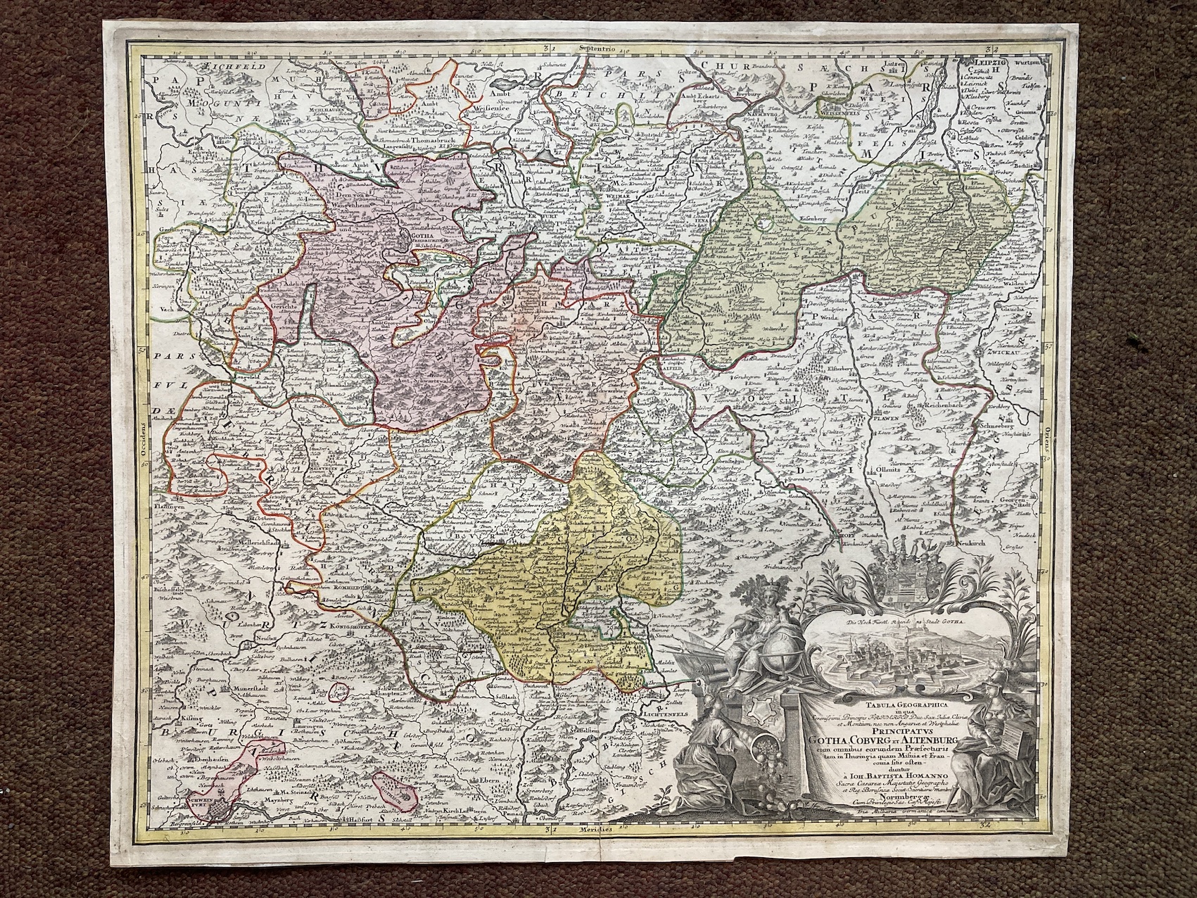
13264. Johann Baptist Homann. PRINCIPATUS GOTHA, COBURG ET ALTENBURG. No date, circa 1730, Nuremberg, 57cm x 50cm hand-coloured. Tape repairs on verso of margin, otherwise very good. 250.00 pounds.
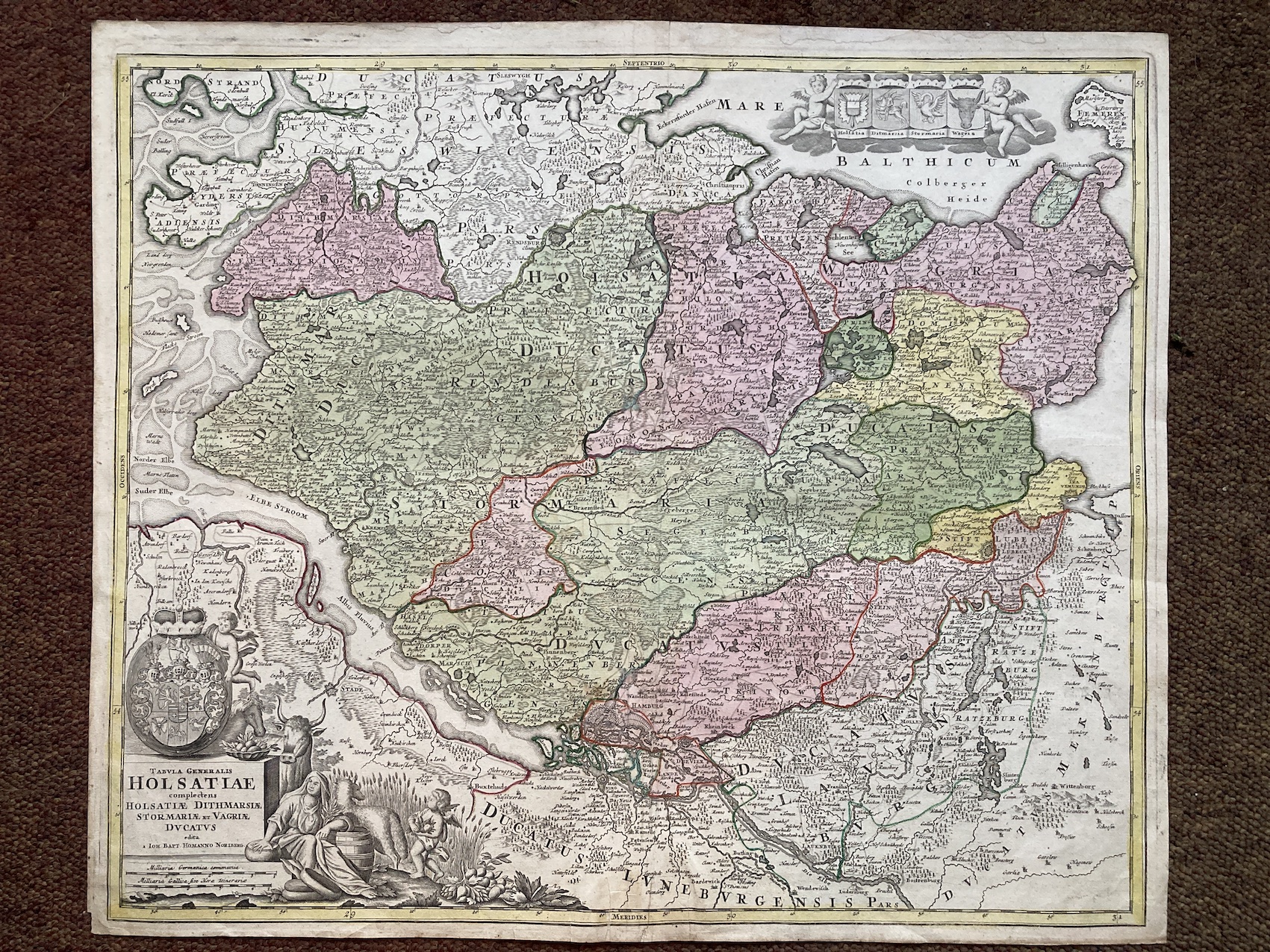
13265. Johann Baptist Homann. TABULA GENERALIS HOLSATIAE... No date, circa 1730, Nuremberg, 59cm x 61cm, hand-coloured. Slight repair at the foot of the centre fold, otherwise very good. 250.00 pounds.
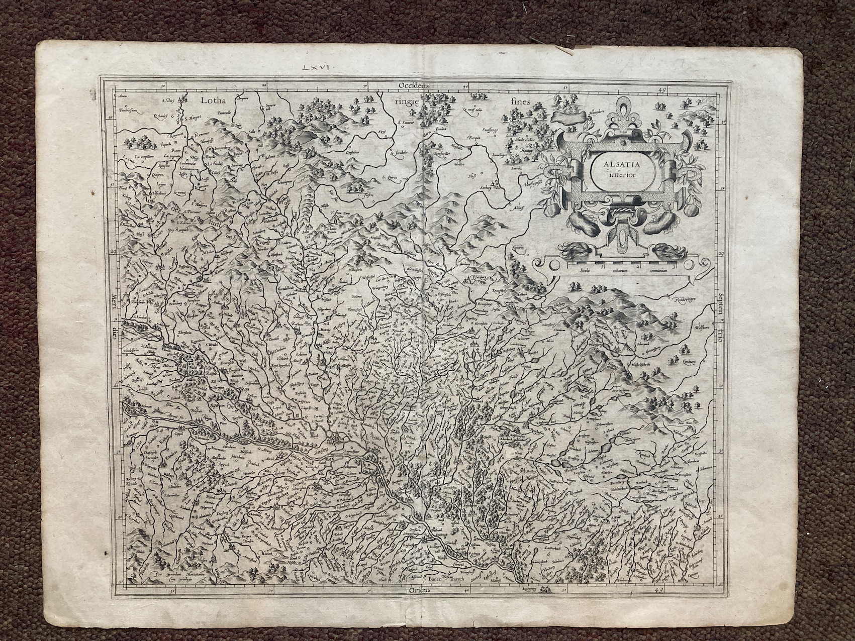
13266. Gerardion Mercatorem. ALSATIA INFERIOR. No date, circa 1610, 53cm x 41cm, uncoloured. A little browned in the margins, otherwise very good. 250.00 pounds.
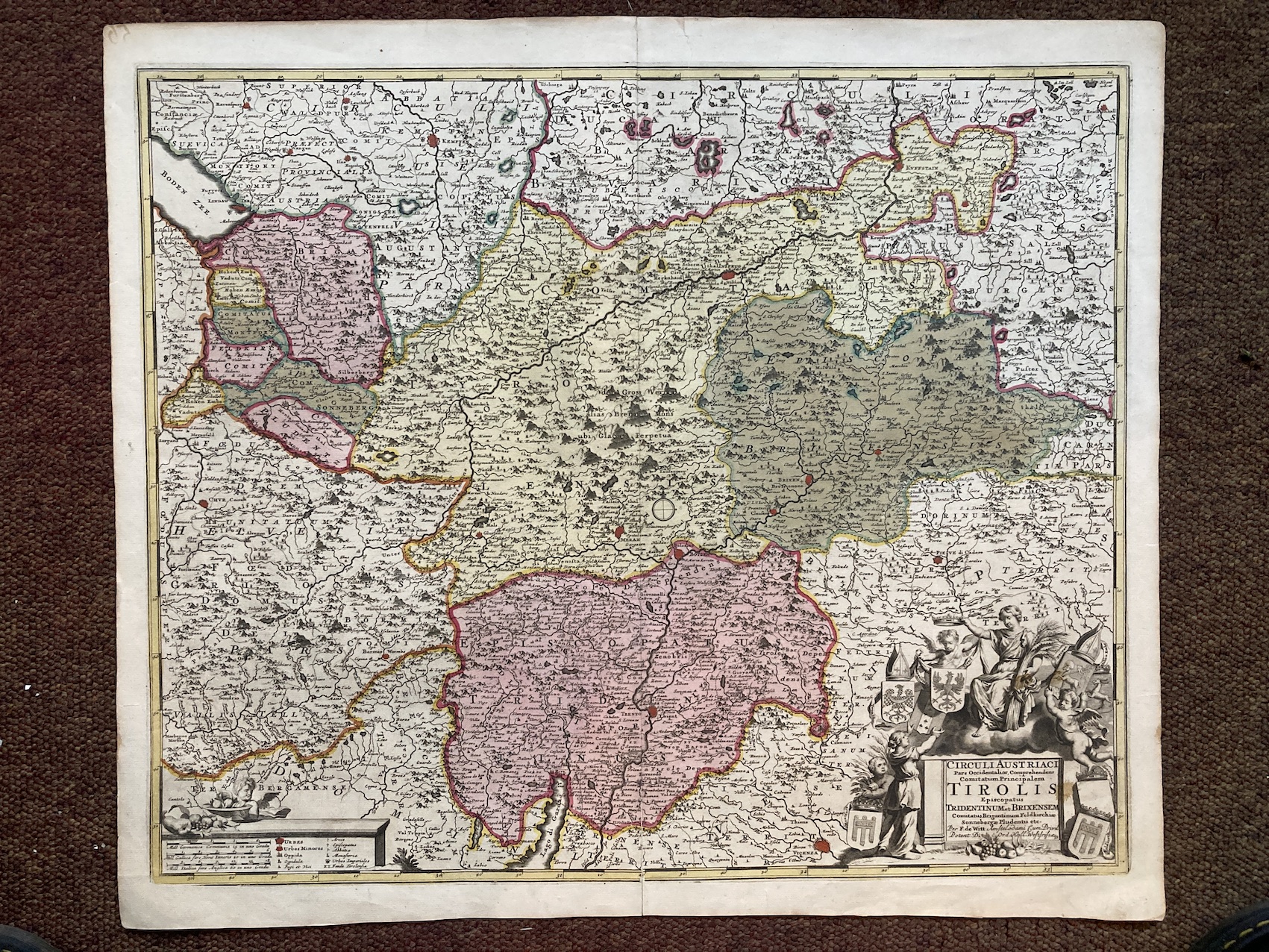
13267. Frederick de Witt. CIRCULI AUSTRIACI ... TIROLIS. No date, circa 1690, Amsterdam, 61cm x 52cm, hand-coloured. Very good. 300.00 pounds.
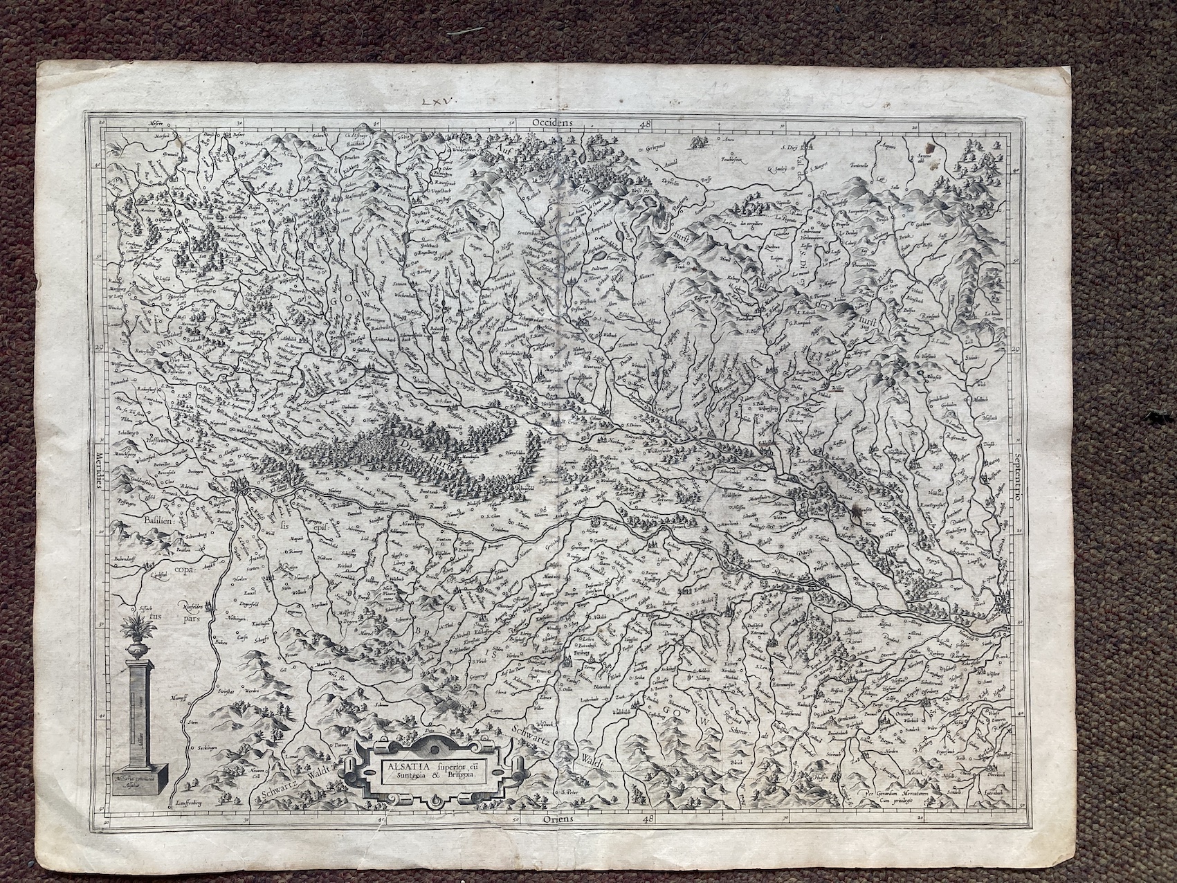
13268. Gerardion Mercatorem. ALSATIA SUPERIOR. No date, circa 1610, 53cm x 41cm, uncoloured. Repair to lower margin, otherwise very good. 250.00 pounds.
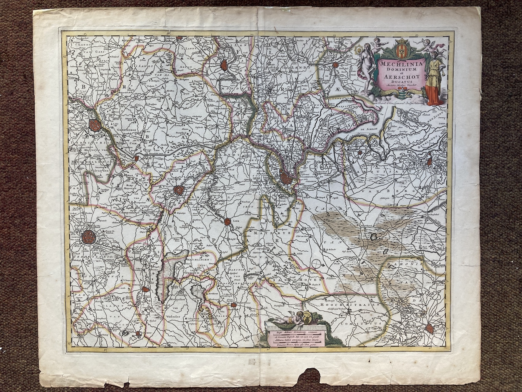
13269. Nicolas Visscher. MECHLINIA DOMINIUM ET AERSCHOT DUCATUS. No date, circa 1680, Amsterdam, 64cm x 54cm, hand-coloured. Repairs to margins, small piece missing, otherwise good. 300.00 pounds.
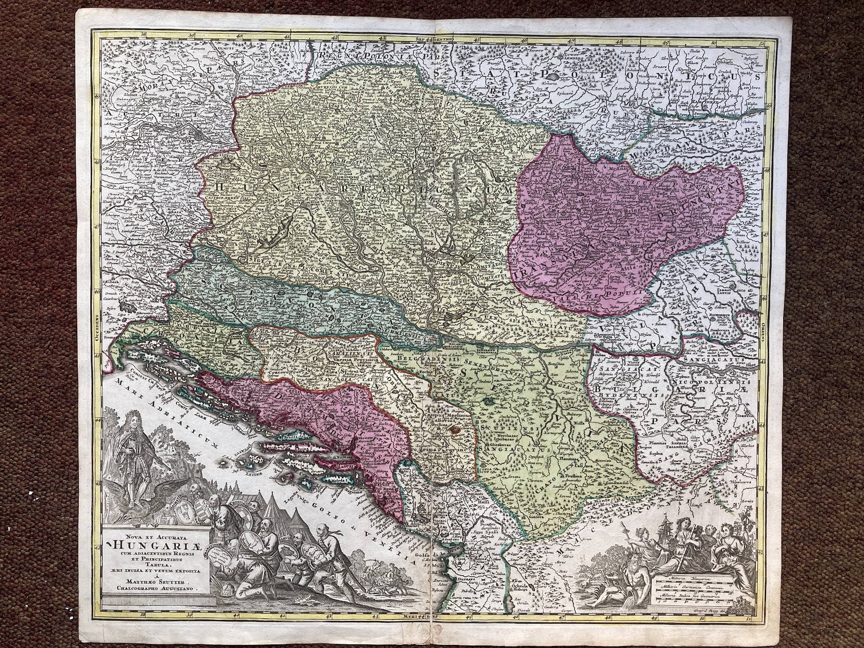
13270. Matthaus Seutter. NOVA ET ACCURAT HUNGARIAE. No date, circa 1740, Augsburg, 60cm x 53cm, hand-coloured. Repair on centre fold, otherwise very good. 250.00 pounds.
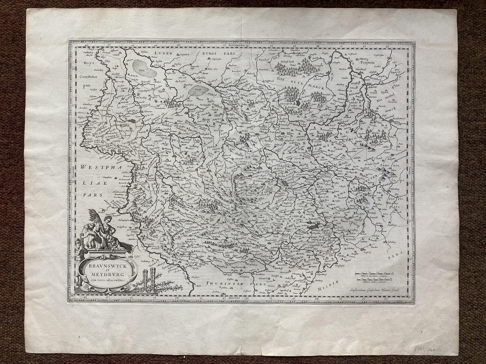
13271. Guilielmus Blaeuw. BRAUNSWYCK ET MEYDBURG. No date, circa 1640, 62cm x 50cm, uncoloured, German text on verso. Very good. 250.00 pounds.
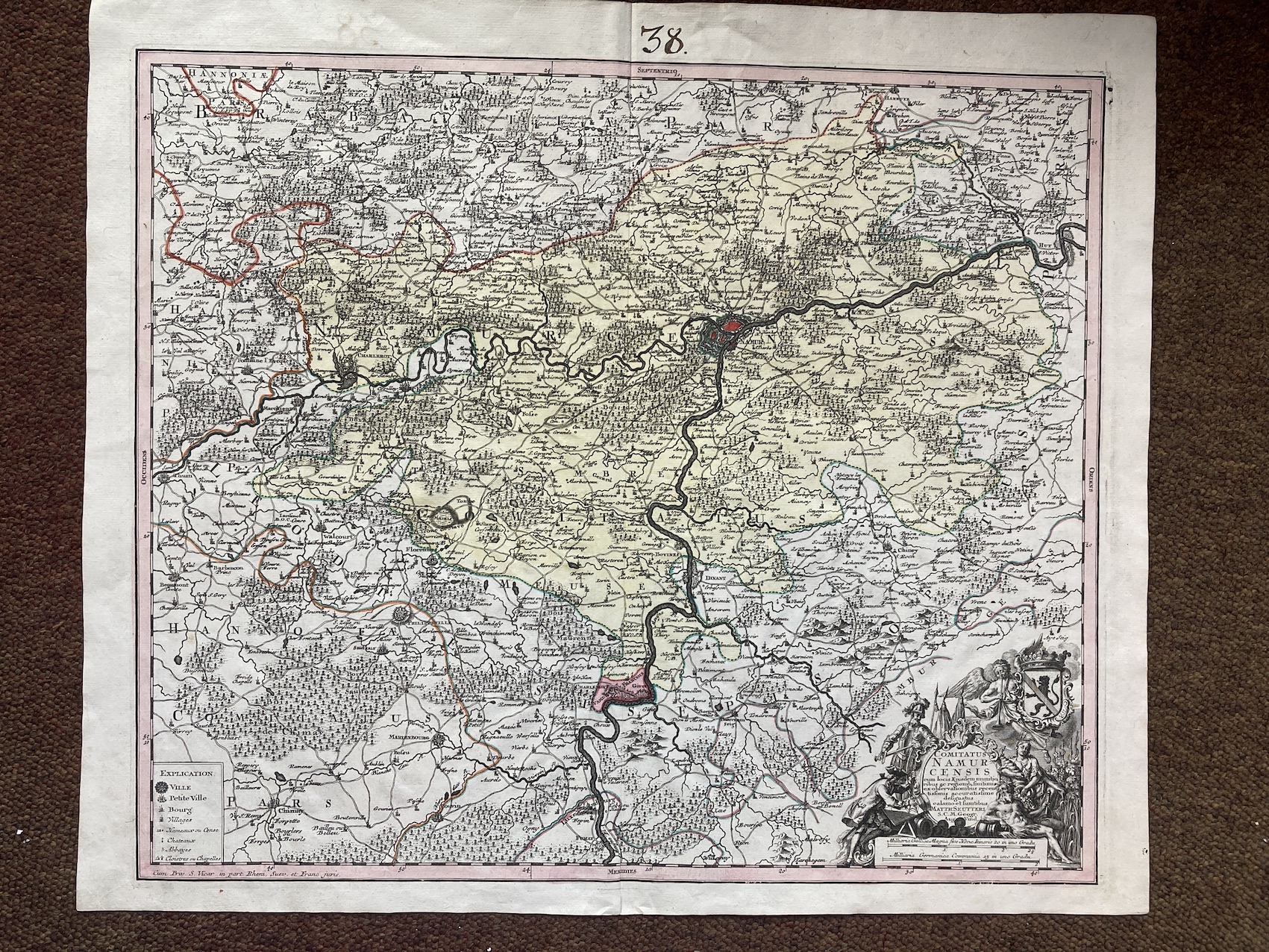
13272. Matthaus Seutter. COMITATUS NAMURCENSIS...Circa1730, Augsburg, 65cm x 54cm, hand-coloured. Very good. 250.00 pounds.
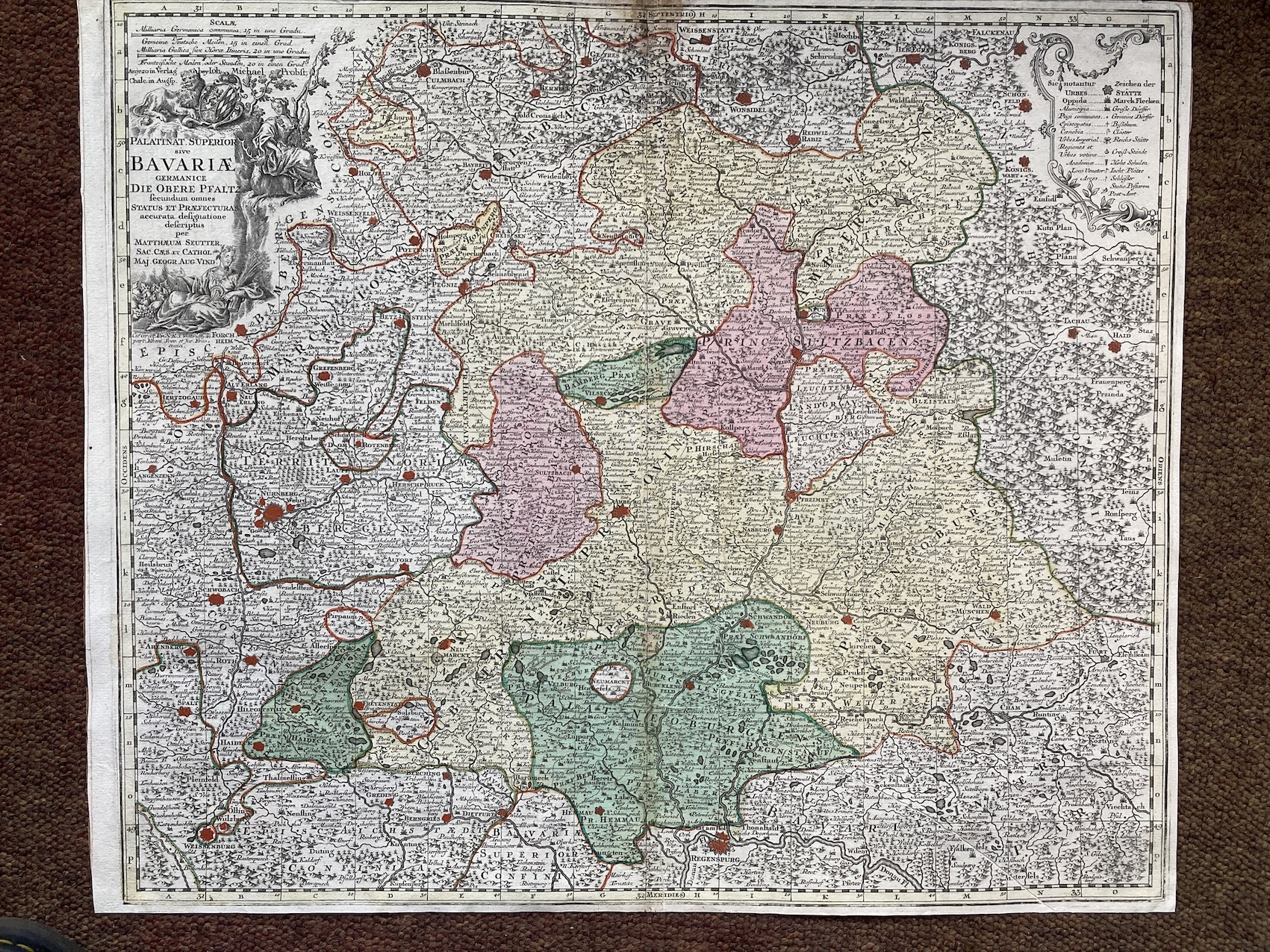
13273. Matthaus Seutter. PALATINAT SUPERIOR SIVE BAVARIAE GERMANICE...Circa 1740, Augsburg, 60cm x 51cm, hand-coloured. Repairs to centre fold, closely trimmed, otherwise good. 200.00 pounds.
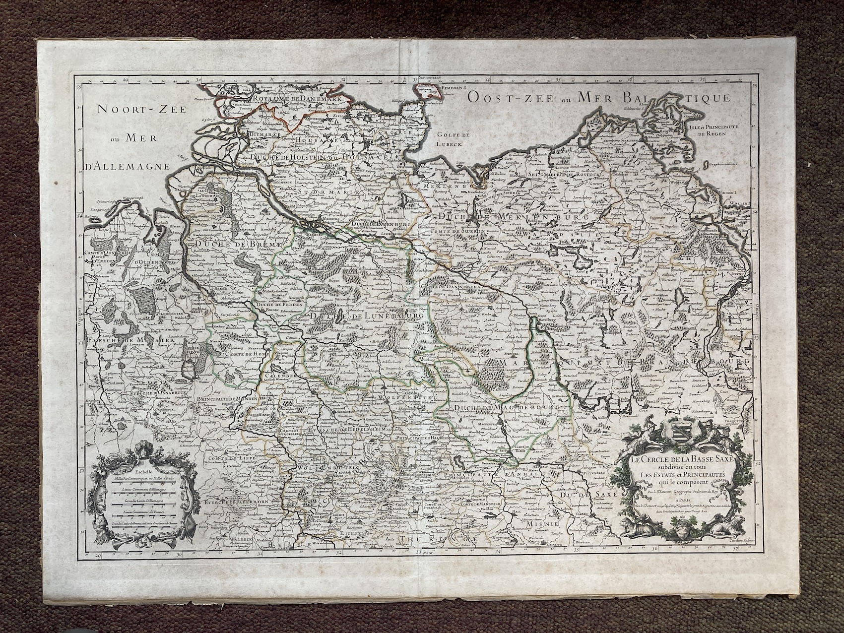
13274. Nicolas Sanson. LE CERCLE DE LA BASSE SAXE... 1692, Paris, Jaillot, engraved by Cordier, 72cm x 53cm, hand-coloured. Reinforcement to edges and centre fold, otherwise good. 250.00 pounds.
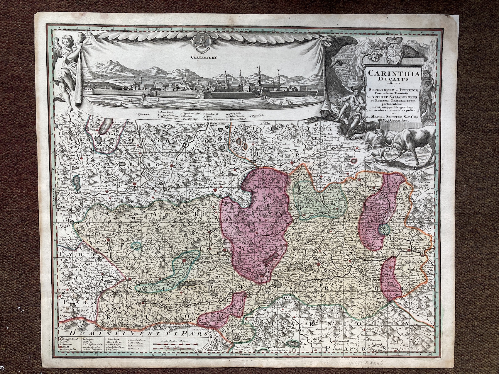
13275. Matthaus Seutter. CARINTHIA DUCATUS DISTINCTA IN SUPERIOREM ET INFERIOR. Circa 1730, Augsburg, 62cm x 53cm, hand-coloured. Very good. 250.00 pounds.
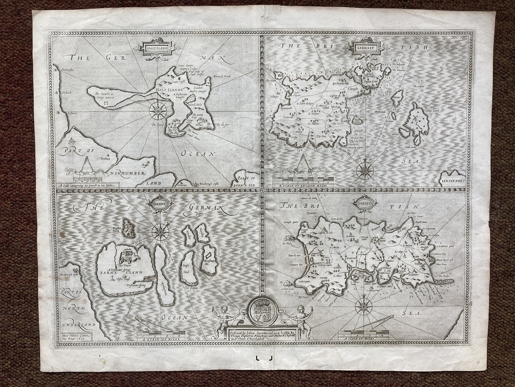
13276. John Speed. HOLY ILAND; FARNE; GARNSEY; JARSEY. 1676, London, Thomas Bassett and Richard Chiswell, after the first edition engraved by Hondius in 1610, 56cm x 43cm, uncoloured, English text on verso. Very good. 350.00 pounds.
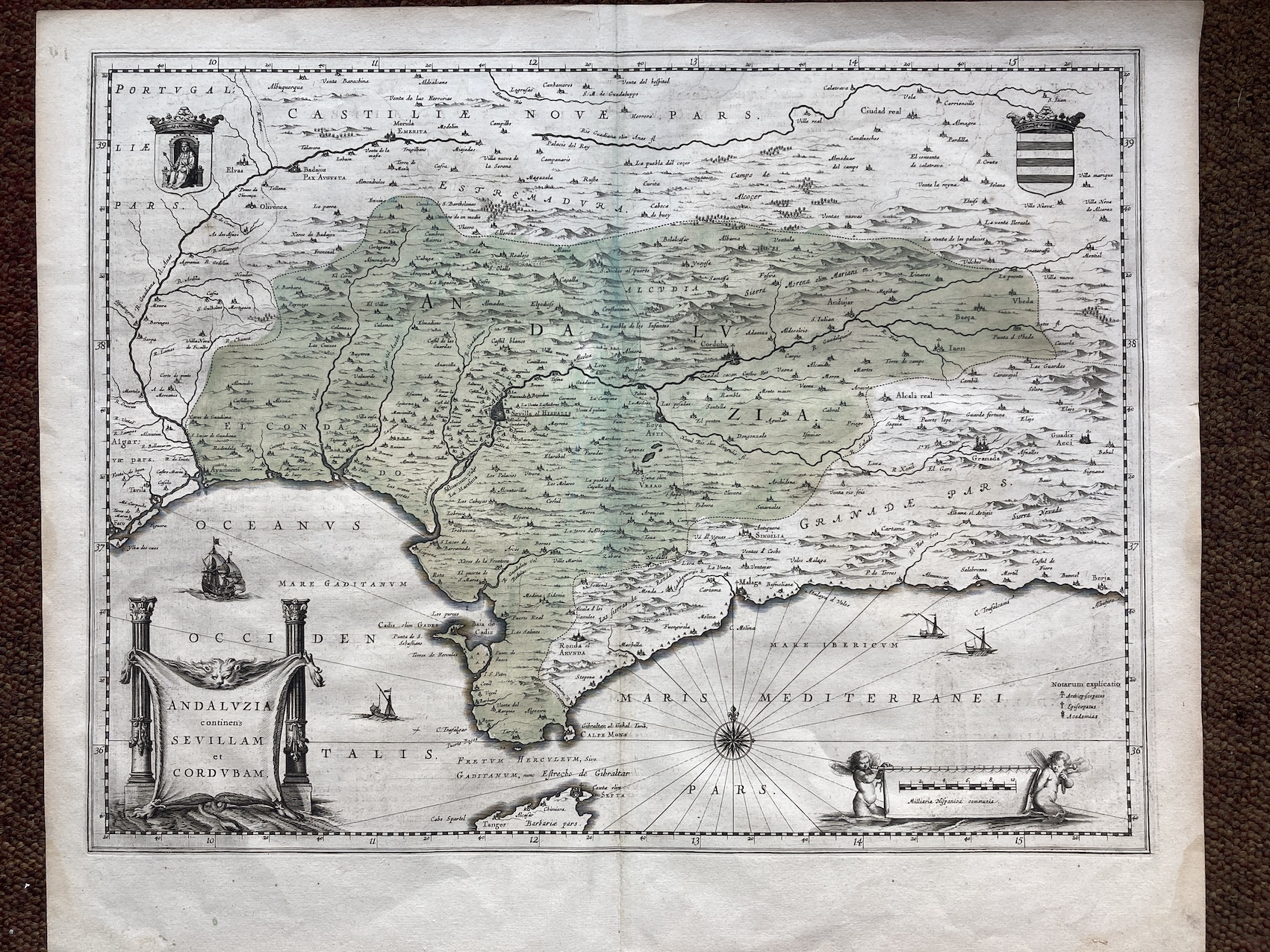
13277. Joan Blaeu. ANDALUZIA CONTINENS SEVILLAM ET CORDUBAM. 1645, Amsterdam, 54cm x 47cm, hand-coloured wash, German text on verso. Very good. 350.00 pounds.
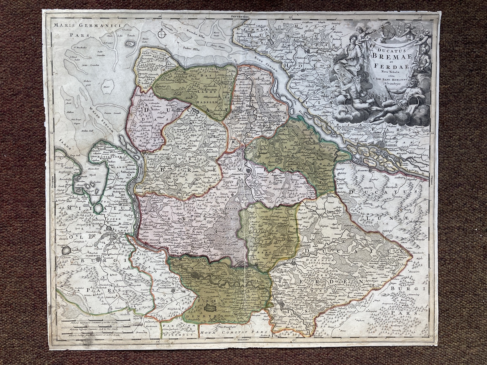
13278. Johann Baptist Homann. DUCATUS BREMAE ET FERDAE. No date, circa 1720, Nuremberg, 58cm x 50cm, hand coloured map. Reinforced on centre fold, otherwise good. 250.00 pounds.
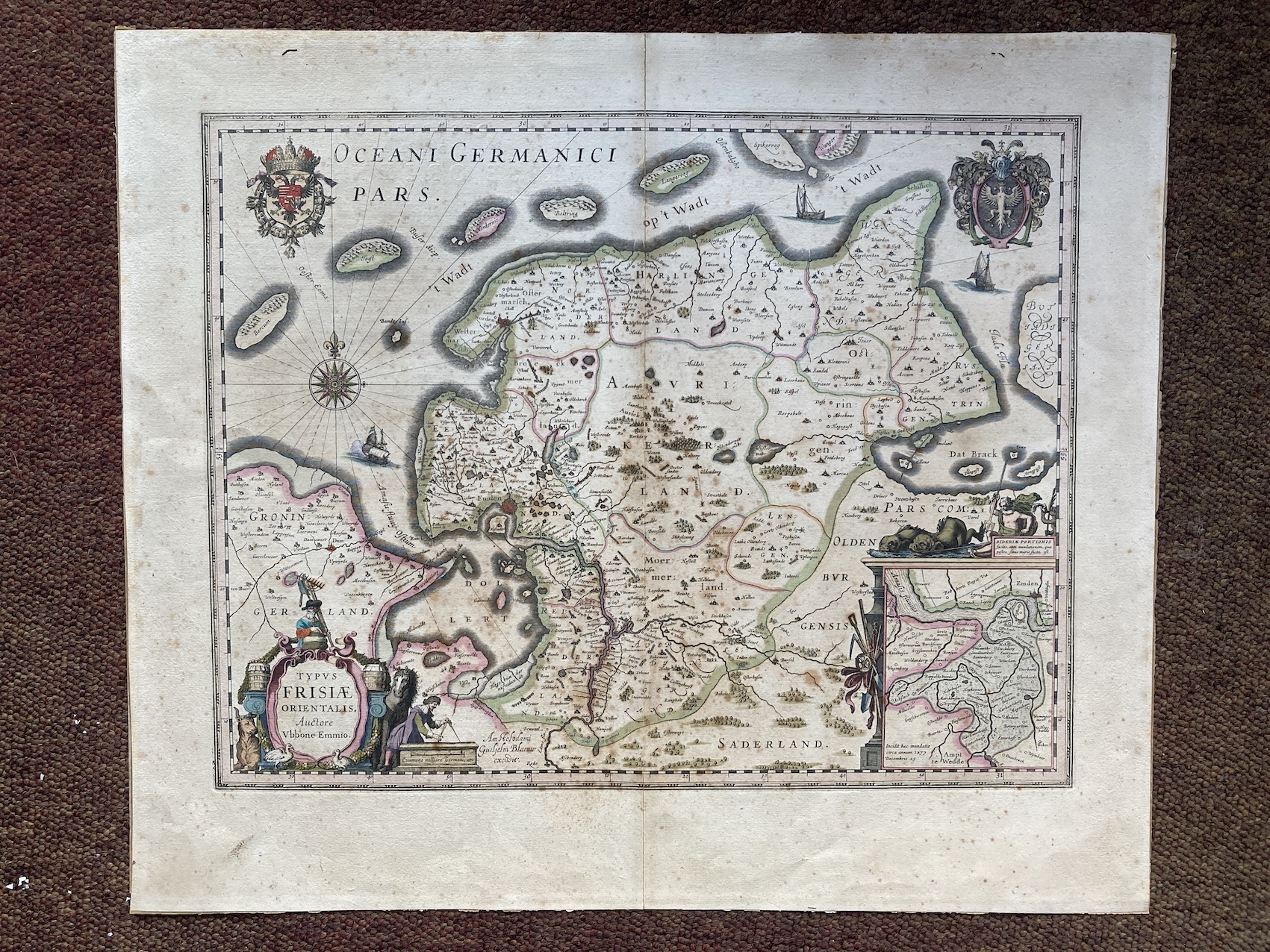
13279. Guillelm Blaeuw. TYPUS FRISIAE ORIENTALIS. AUCTORE UBBONE EMMIO. No date, circa 1640, Amsterdam, 57cm X 49cm, hand coloured, French text on verso. Reinforced on centre fold, slightly foxed. 250.00 pounds.
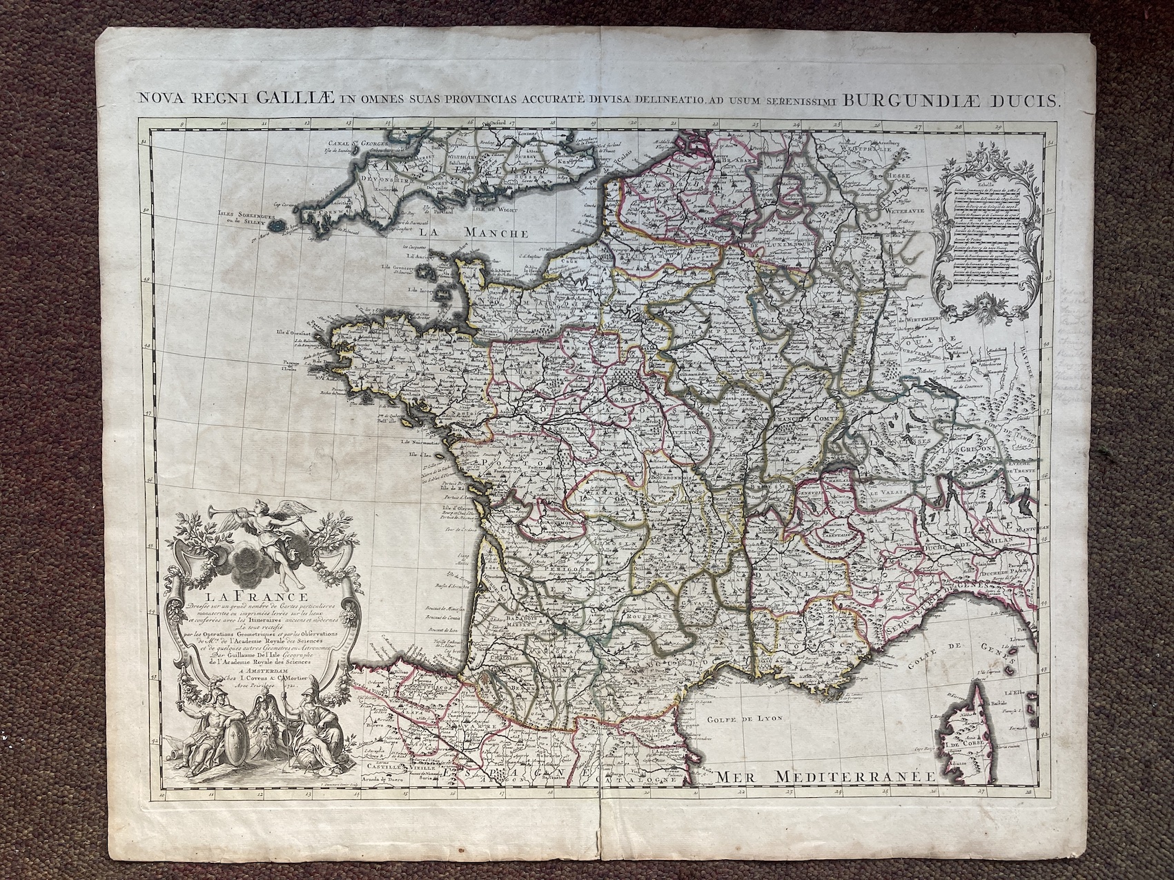
13280. Guillaume De L'Isle. LA FRANCE..1721, Amsterdam, I. Covens & C. Mortier, 64cm x 54cm, hand coloured outline, ornamental cartouche. Reinforced on centre fold, otherwise good. 150.00 pounds.
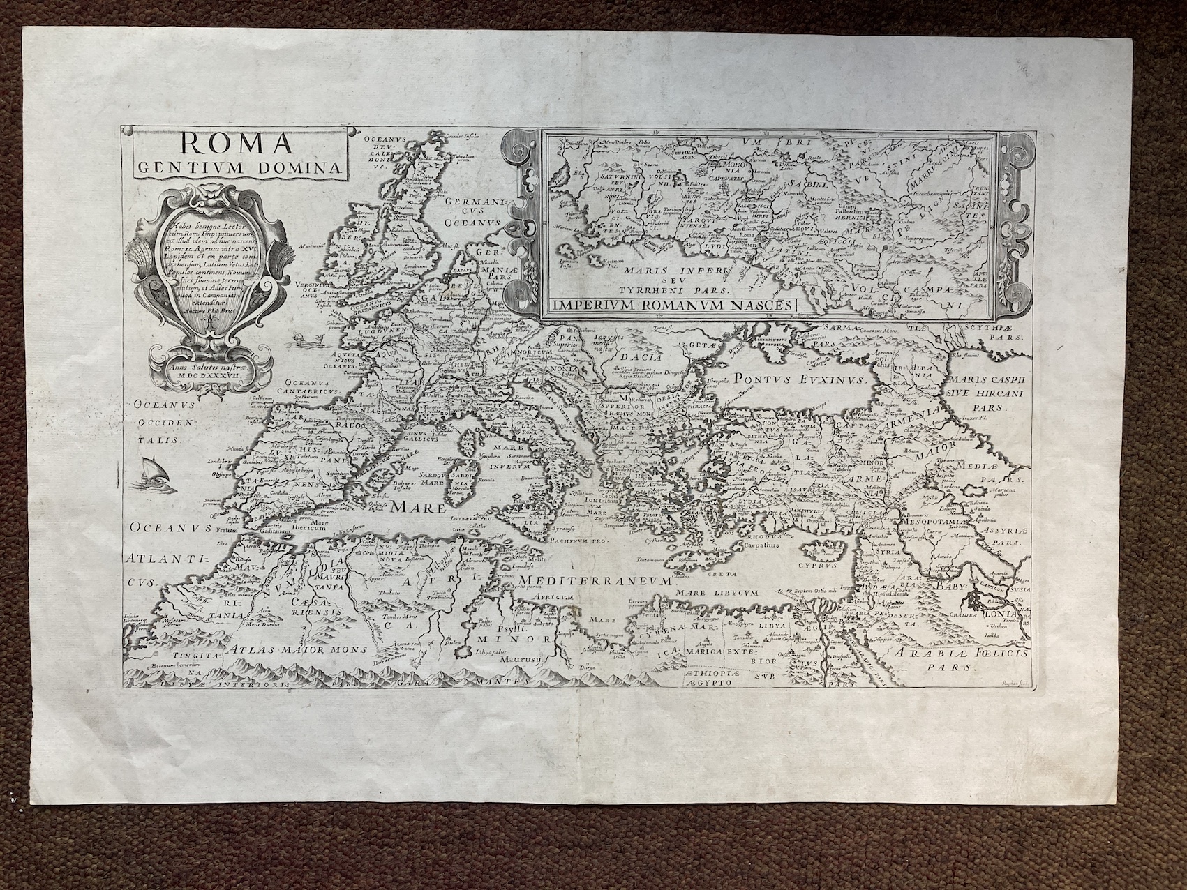
13281. Philippe Briet. ROMA GENTIUM DOMINA.1687, engraved by Ruphon, 60cm x 42cm, uncoloured map. Very good. 250.00 pounds.
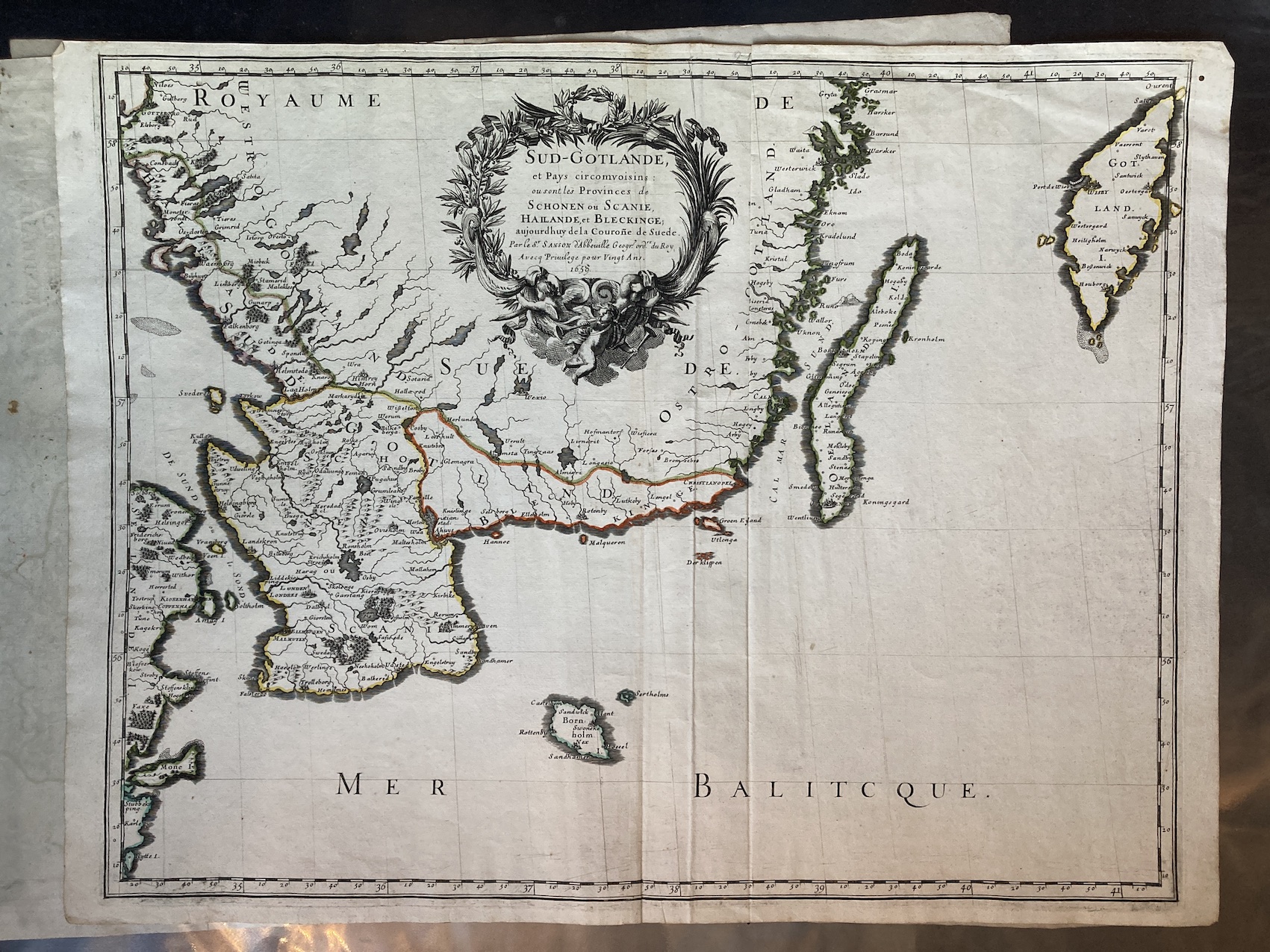
13282. Nicolas Sanson. SUD-GOTLANDE...1659, Paris, 58cm x 43cm, hand-coloured outline. Very good. 250.00 pounds.
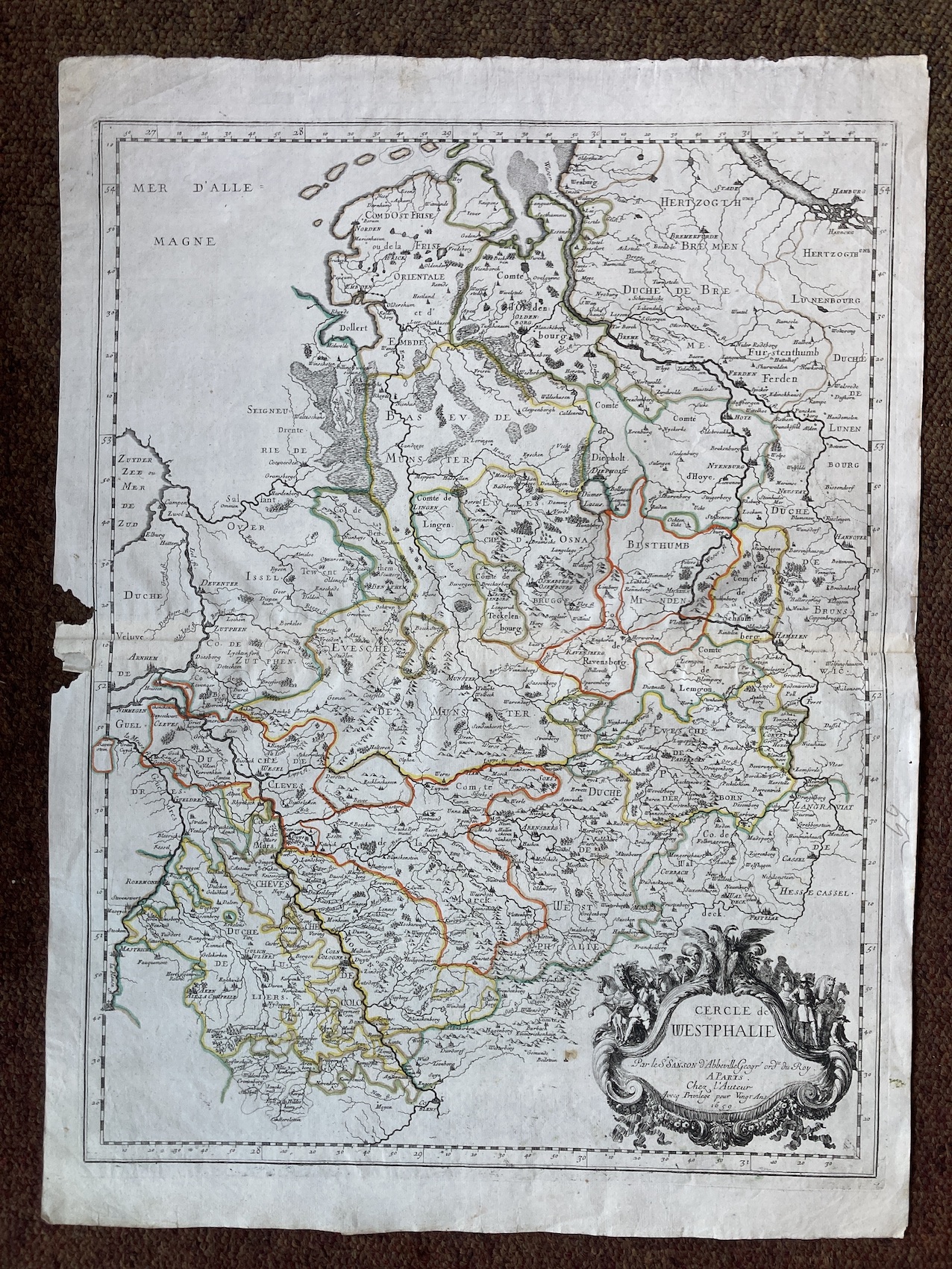
13283. Nicolas Sanson. CERCLE DE WESTPHALIE. 1659, Paris, 58cm x 43cm, hand-coloured outline. Slight worm damage. 250.00 pounds.
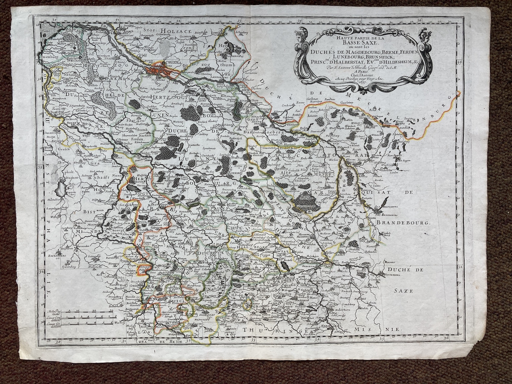
13284. Nicolas Sanson. HAUTE PARTIE DE LA BASSE SAXE... 1657, Paris, 58cm x 43cm, hand-coloured outline. Very good. 250.00 pounds.
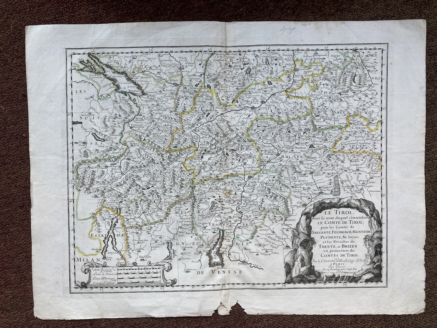
13285. Nicolas Sanson. LE TIROL... 1654, Paris, 58cm x 43cm, hand-coloured outline. Scarce. Insect damage in lower margin, otherwise very good. 250.00 pounds.
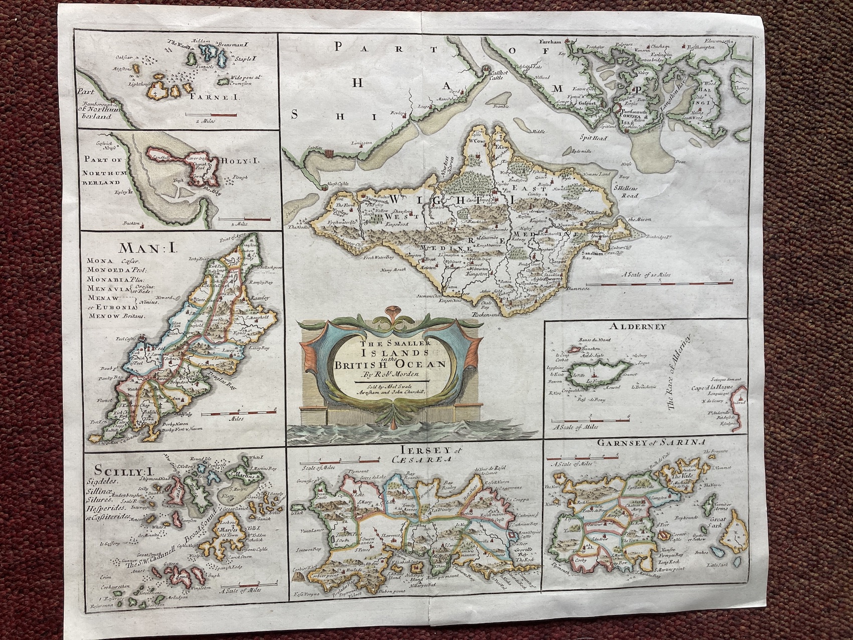
13286. Robert Morden. THE SMALLER ISLANDS IN THE BRITISH OCEAN. 1695 or later, sold by Abel Swale Awnsham and John Churchill, 45cm x 39cm, hand-coloured. Very good. 200.00 pounds.
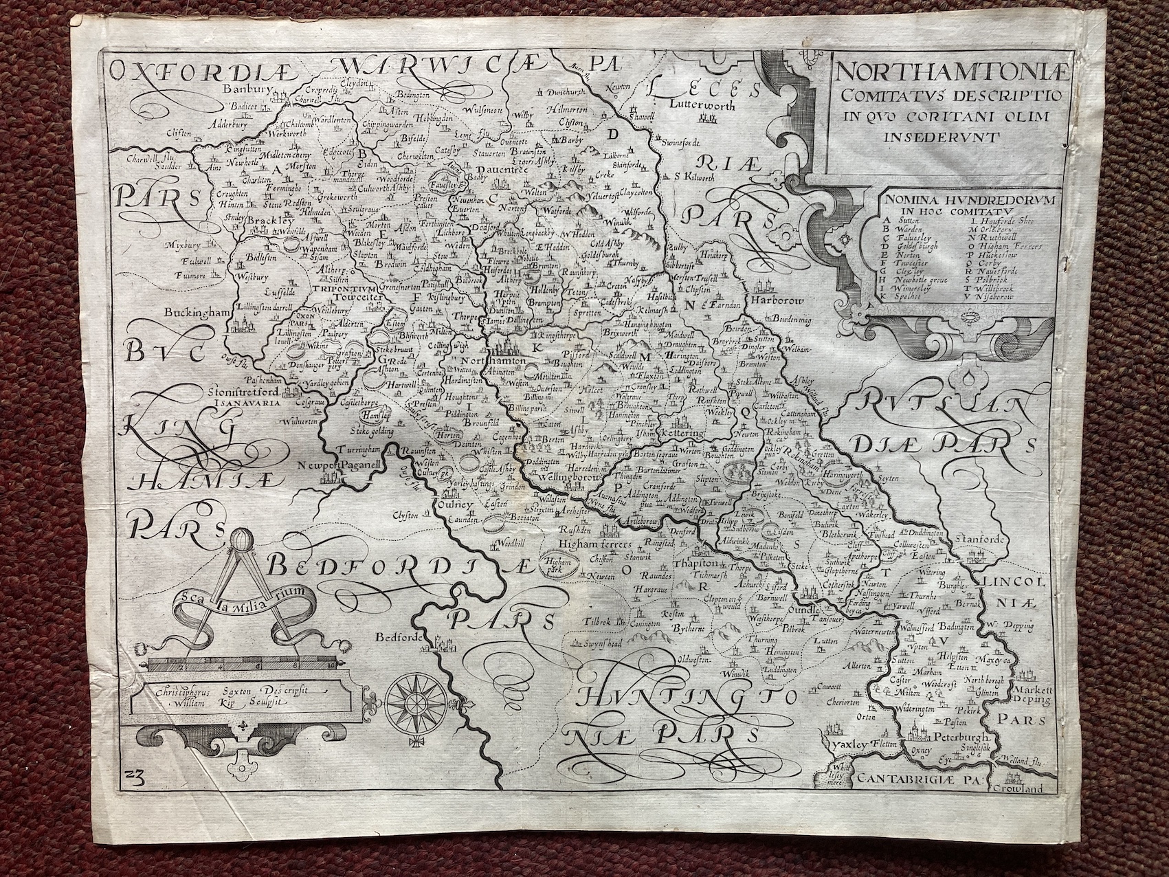
13287. Christopher Saxton engraved by William Kip. NORTHAMPTONIAE. COMITATUS DESCRIPTIO IN QUO CORITANI OLIM IN SEDERUNT. Circa 1610, verso blank, uncoloured, 38cm x 31cm. Very good. 225.00 pounds.
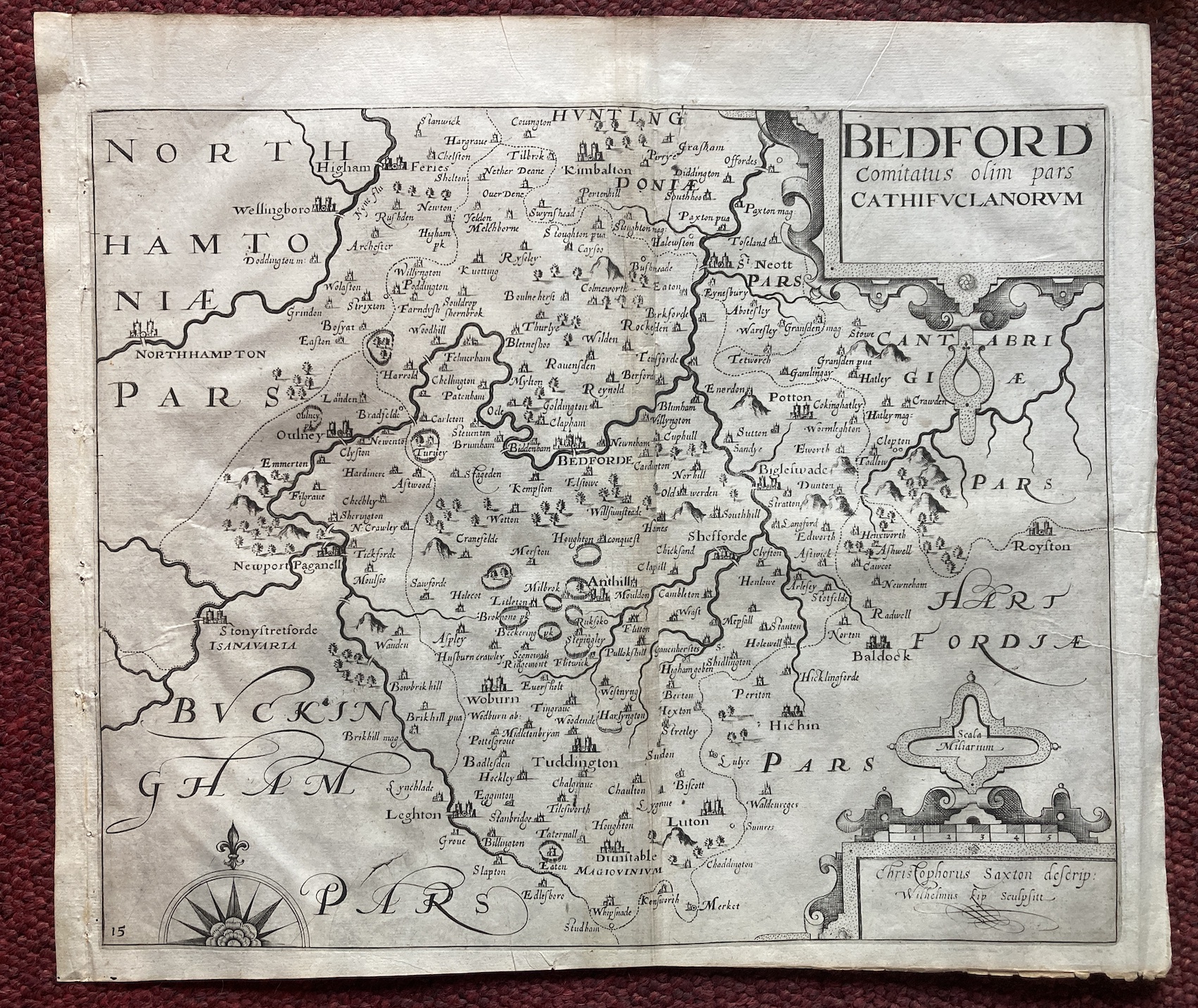
13288. Christopher Saxton engraved by William Kip. BEDFORD COMITATUS OLIM PARS CATHIFUCLANORUM. Circa 1610, verso blank, uncoloured, 38cm x 31cm. Very good. 175.00 pounds.
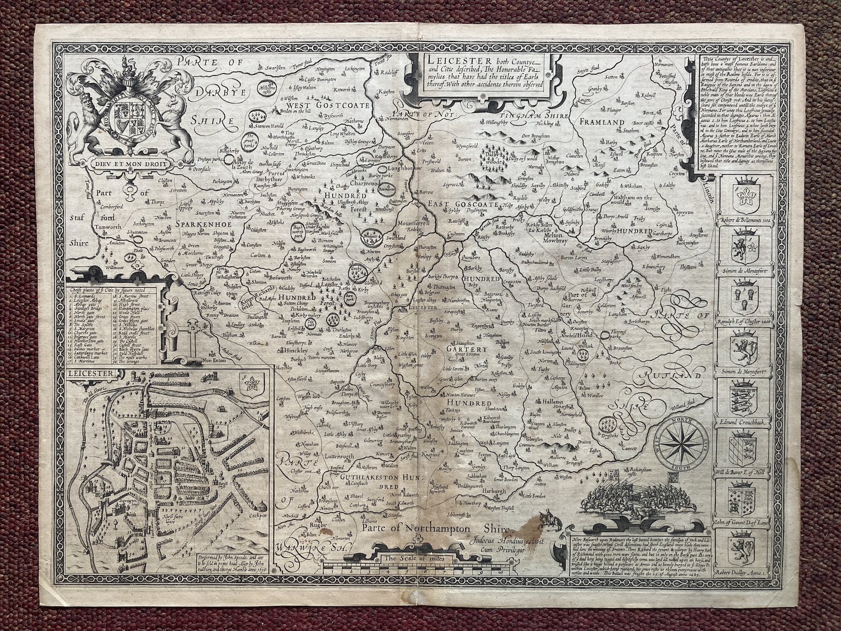
13289. John Speed. LEICESTER BOTH COUNTYE-AND CITIE DESCRIBED, THE HONORABLE FAMYLIES THAT HAVE HAD THE TITLES OF EARLS THEREOF. WITH OTHER ACCIDENTS THEREIN. 1611, John Sudbury and George Humble, engraved by Jodocus Hondius, 515mm x 385mm with good margins, the first and best edition, from THEATRE OF THE EMPIRE OF GREAT BRITAIN. uncoloured. Slight repair on hinge, slightly browned. 300.00 pounds.
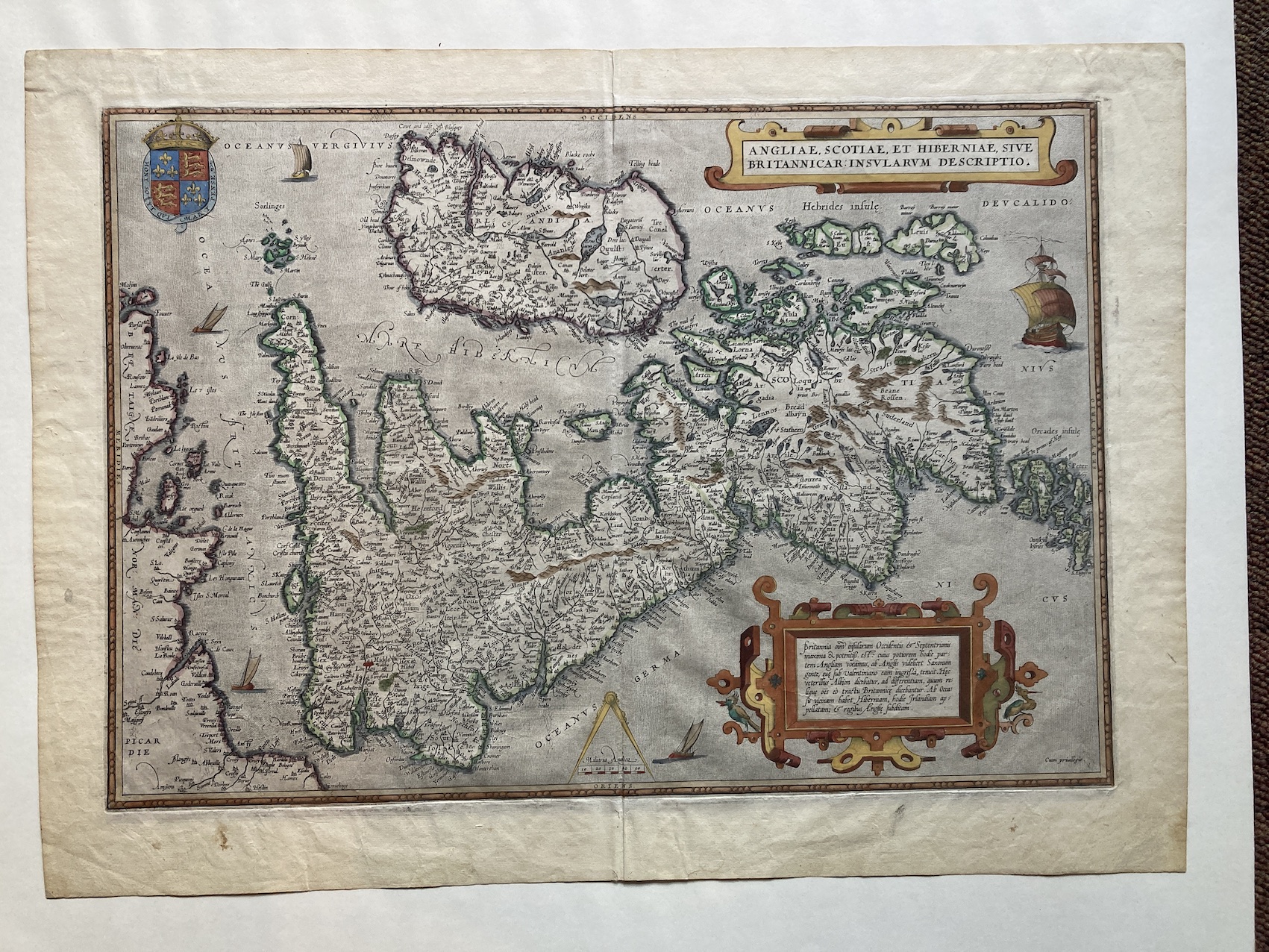
13290. Abraham Ortelius. ANGLIAE, SCOTIAE, ET HIBERNIAE,SIVE BRITANNICAR: INSULARUM DESCRITIO. 1583 or later, Antwerp, copper engraving, hand-coloured, 345mm x 500mm, good margins, Latin text on verso. We believe this to be the second state of the map from 1583 or later (see Moreland & Bannister p.200-203), althought the various issues over the years are notoriously difficult to differentiate. The French coastline of Brittany, Normandy and Picardy is well charted on the left hand side, and the oceans abound with sailing vessels. Ortelius' map of Great Britain was based largely on his friend Mercator's map, and was published in his "Theatrum Orbis Terrarum" from 1570 onwards, which was regarded as the first 'modern ' atlas. The map is turned to show north at the right, enabling better use of the printed paper-potentially prophesying the UK on its back after Brexit? Creased on centrefold, otherwise very good indeed. 1000.00 pounds.
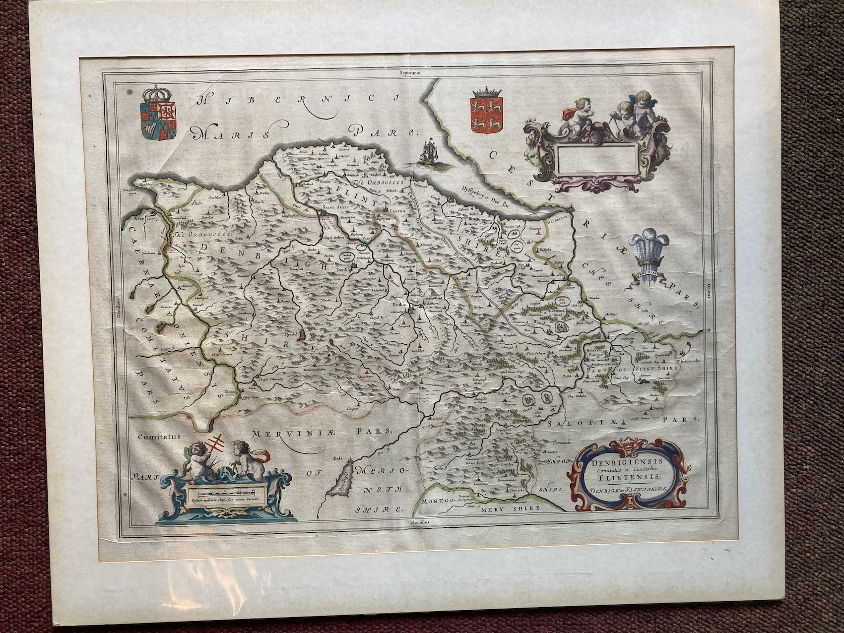
13291. Joan Blaeu. DENBIGIENSIS COMITATUS ET COMITATUS FLINTENSIS; DENBIGH ET FLINTSHIRE. Circa 1650, 500mm x 390mm, hand-coloured, mounted, unframed. The first edition of this map, with Dutch text on verso. John Blaeu, eldest son and business successor of Willem Blaeu, was responsible for the publication of a country atlas of England and Wales in 1645. It appeared as volume four of the Latin edition of the "Atlas Novus". The Dutch Blaeu family was the most highly esteemed and prolific publisher of the seventeenth century. The father established the business in 1599 (he was a scientific instrument maker) and published the first one volume atlas of the world in 1630. The effects and quality of production of the Blaeu output has remained impressive to this day. Slightly creased, but generally very good. 200.00 pounds.